What's new in SURE 4.4
SURE 4.4 brings you a boost in usability, mesh quality, and smart usage of your production resources.
Experience efficient and convenient streaming behavior of meshes even on weak hardware. The new automatic area shapefile feature guarantees the best output quality at efficient usage of resources. Further improvements will increase the quality of your results while granting enhanced usability and compatibility.
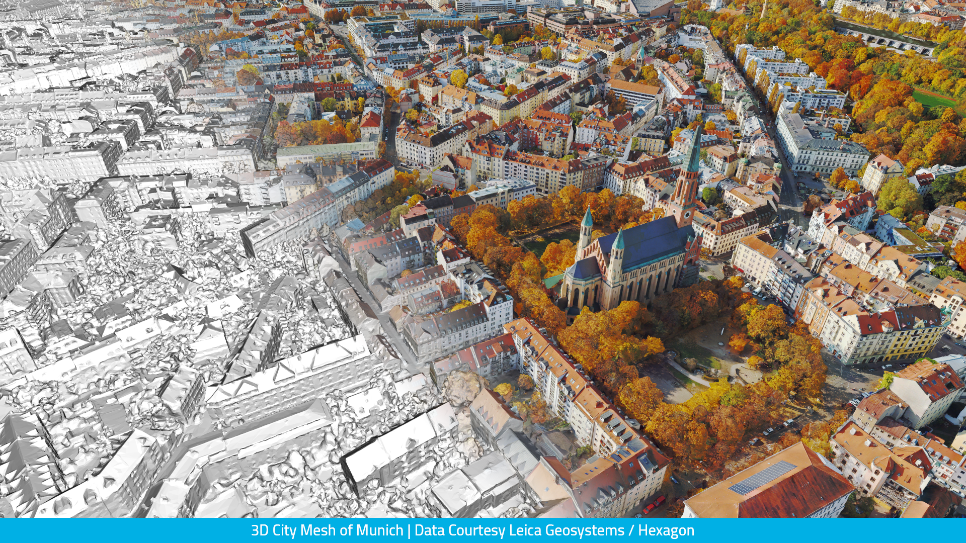
Streaming | Level of Detail
Experience seamless loading behavior of detailed, complete, and crisp meshes. Meshes are now interactively usable even on low-end hardware. This is possible due to reduced resource consumption such as graphics memory.
Strong reduction of triangle count | Up to 10x fewer triangles loaded
Number of triangles loaded and displayed in a single view is reduced up to 10x, leading to reduced data transfer and graphics memory while maintaining geometric integrity.
Smaller texture atlases | Up to 50% less texture memory used
Smarter usage of texture atlases leads to further reduced load on graphics memory, enabling seamless streaming experience on low-end hardware.
Foreground is loaded faster | Up to 2x faster loading times
Rebalanced tree structure enables greatly improved viewing experience.
3D Mesh City of Frankfurt/Main | Data Courtesy: Aerowest
Area of Interest | Automatic Area Shapefile
Let SURE take over when it comes to selecting an area of interest for your dataset. In case you don’t specify an area of interest, SURE will automatically select the area that can be reconstructed well — matching your desired quality, accuracy, and coverage.
Avoid interpolated regions at dataset boundaries in raster products.
Reduce processing time significantly - especially for datasets with a clear separation of foreground and background.
Deliver improved areas of interest for drone, hero style, oblique, and nadir flights.
Tile Naming | TilesShape.shp
SURE now adds a unique ID to each tile polygon in the TileShape.shp corresponding to the file names of your output products.
Gain a better overview of your results by inspecting the automatically generated TilesShape in combination with your raster products and use it in deliveries to customers.
Enable easier and faster custom workflows — easily derive the tile name for the spatial location you are currently working on in your GIS.
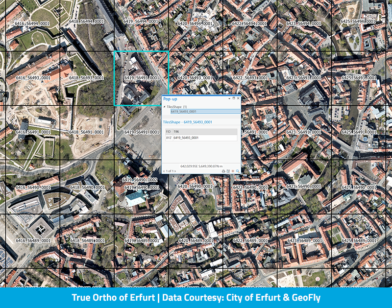
The TileShape.shp is imported into ArcGIS, with the unique ID representing the respective tile polygon
Usability & Compatibility
Introduced automatic output of VRT files for all raster products (DSM, DSM Metainformation, True/DSM Ortho) to simplify loading and enable faster workflows in ArcGIS and other GIS applications.
Stereo model information is stored more efficiently reducing disk space and RAM usage, especially for large projects.
Optimized compression level of JPEG textures for obj & dae meshes leads to more detail and fewer compression artifacts.
We are happy to hear your thoughts — get in touch! https://www.nframes.com/contact-us/