What's new in SURE 5.2
SURE 5.2 enables a more cost-effective True Ortho and Mesh generation by reducing both processing time and hardware requirements. 3D Mesh production workflows have become easier than ever before, while delivering better looking results out of the box! Mesh Editing and Clipping is introduced, facilitating the delivery of areas of interest to your customer. Additional flexibility is at your fingertips with the capability of incorporating LiDAR data from multiple flight days.
Faster production time and decreased disk space
Reduce your delivery time and hardware cost for single-node and distributed processing. With SURE 5.2 disk space requirements are significantly decreased for any size of project due to the new default point cloud compression (.laz). Yet, export in .las format is still an available option. Our noteworthy performance improvements guarantee speedy processing without compromising on quality.
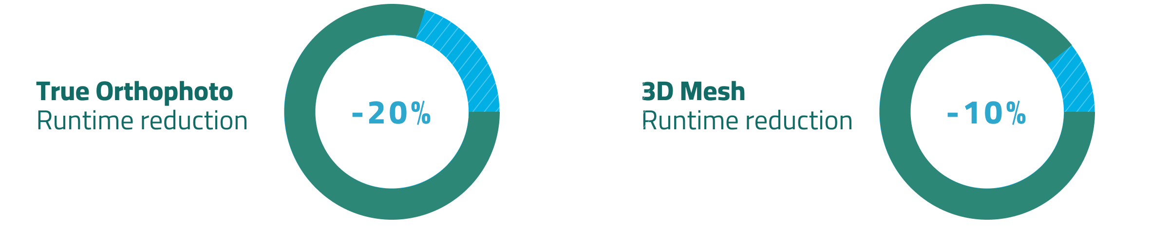
Get your products delivered even faster
True Orthophoto production up to 20% faster
3D Mesh production up to 10% faster
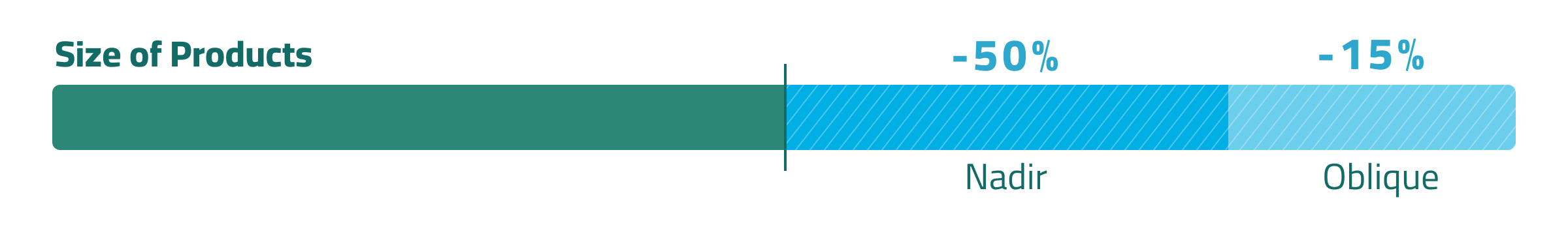
Significant disk space savings due to point clouds written in compressed .laz format by default
True Ortho projects require up to 50% less disk space
3D Mesh projects require up to 15% less disk space
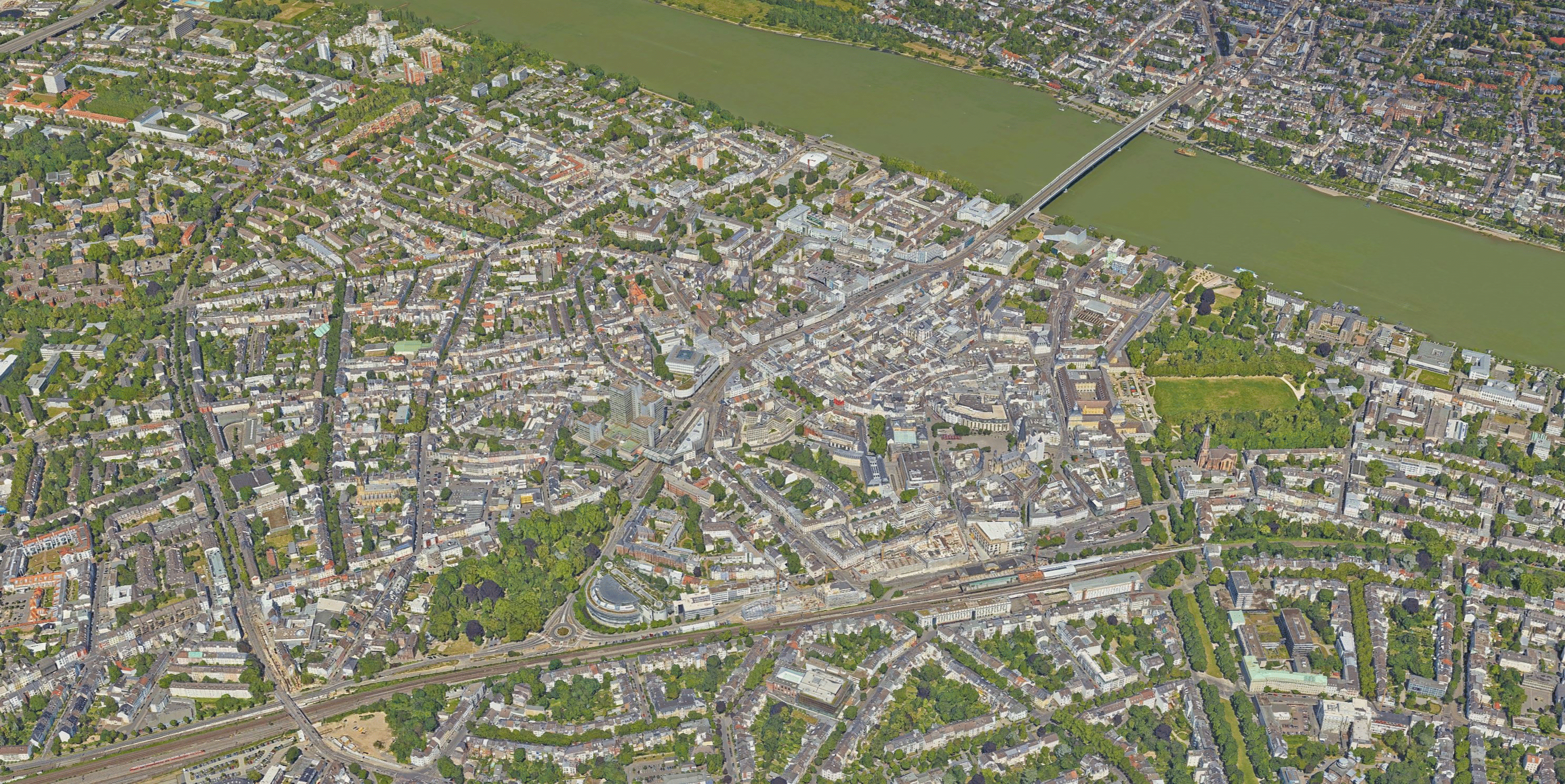
Improved 3D Mesh Production
Produce 3D Meshes with minimal effort with the integration of LiDAR data from multiple flight days and coordinate system transformations involving transformation grids. All this comes with an overall improvement of quality, further reducing the need for editing by improving on the overall geometric representation of the Mesh, both with and without the integration of LiDAR data.
Improved LiDAR integration and support of multiple flight days
LiDAR points have a stronger influence in the 3D Mesh generation, improving the ability of SURE to carve out narrow spaces between buildings and other features only accurately observed by LiDAR
It is now possible to utilize LiDAR input from multiple flight days in the 3D Mesh workflow. For more information please also refer to our documentation.
Overall quality
SURE 5.2 features multiple improvements that further enhance the 3D Mesh quality and improve topology (e.g., disconnected larger triangles or holes)
New & improved handling of data in coordinate systems with geoid heights
You can now utilize compound (horizontal + vertical) coordinate systems to produce geographically correct outputs in your project coordinate system, so that your data is where you want it to be directly out of SURE
Utilize transformation grid files to accurately transform your 3D Mesh results to globe coordinate systems, required for efficient web-streaming
Mesh Editing Workflow
SURE 5.2 comes with an enhanced Mesh Editing workflow. This workflow enables the editing of areas of your dataset that pose special challenges for photogrammetry, like glass or other reflective surfaces. As part of this workflow you can incorporate everything from simple edits, up to the insertion of pre-existing 3D models.
Use SURE to export editing-ready Meshes of areas requiring special care
Perform editing within the tool you feel most comfortable with
Integrate edits in a performant manner, only updating those parts of the Mesh that were edited
Perform editing incrementally, allowing to add further edits to an already edited Mesh
Please follow this link for a detailed workflow tutorial.
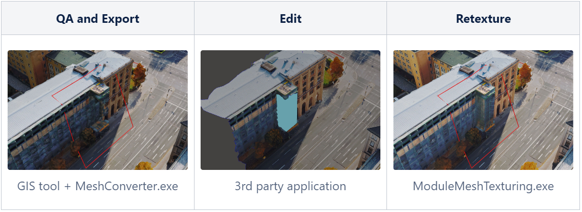
New Mesh Clip and Ship
Using the mesh conversion capabilities of SURE, it is now possible for you to deliver arbitrary areas of interest of your Mesh to your end customer in all formats supported by SURE, most notably OGC I3S, OGC 3D Tiles and OBJ.
Define arbitrary polygons to extract Meshes for areas of interest from your larger Mesh
Use polygons to create cut-outs, in order to remove restricted areas from your Mesh deliverable
General enhancements
SURE 5.2 brings several improvements to simplify and speed up your workflows.
Unified way of defining project area and tiling scheme
Be able to edit your raster products that were processed in distributed processing
From now on all DSM Raw files are automatically collected from the processing nodes
Better rendering performance and default values for raster products (DSMs, True Orthos, Metainformation Layers) in common GIS applications
DSM Binary Mask now treats points introduced from waterbody or correction shapefiles as synthetic
We are happy to hear your thoughts — get in touch! https://www.nframes.com/contact-us/