3D Mesh
Formats | OSGB | 3D TILES | I3S (SLPK) | OBJ | LOCAL_OBJ |
Use cases | City Modelling | Infrastructure Planning and Optimization | 5G Network Design | Insurance Industry | Cultural Preservation | Risk Analysis |
Alternative names | 3D Model | Mesh Model | City Model |
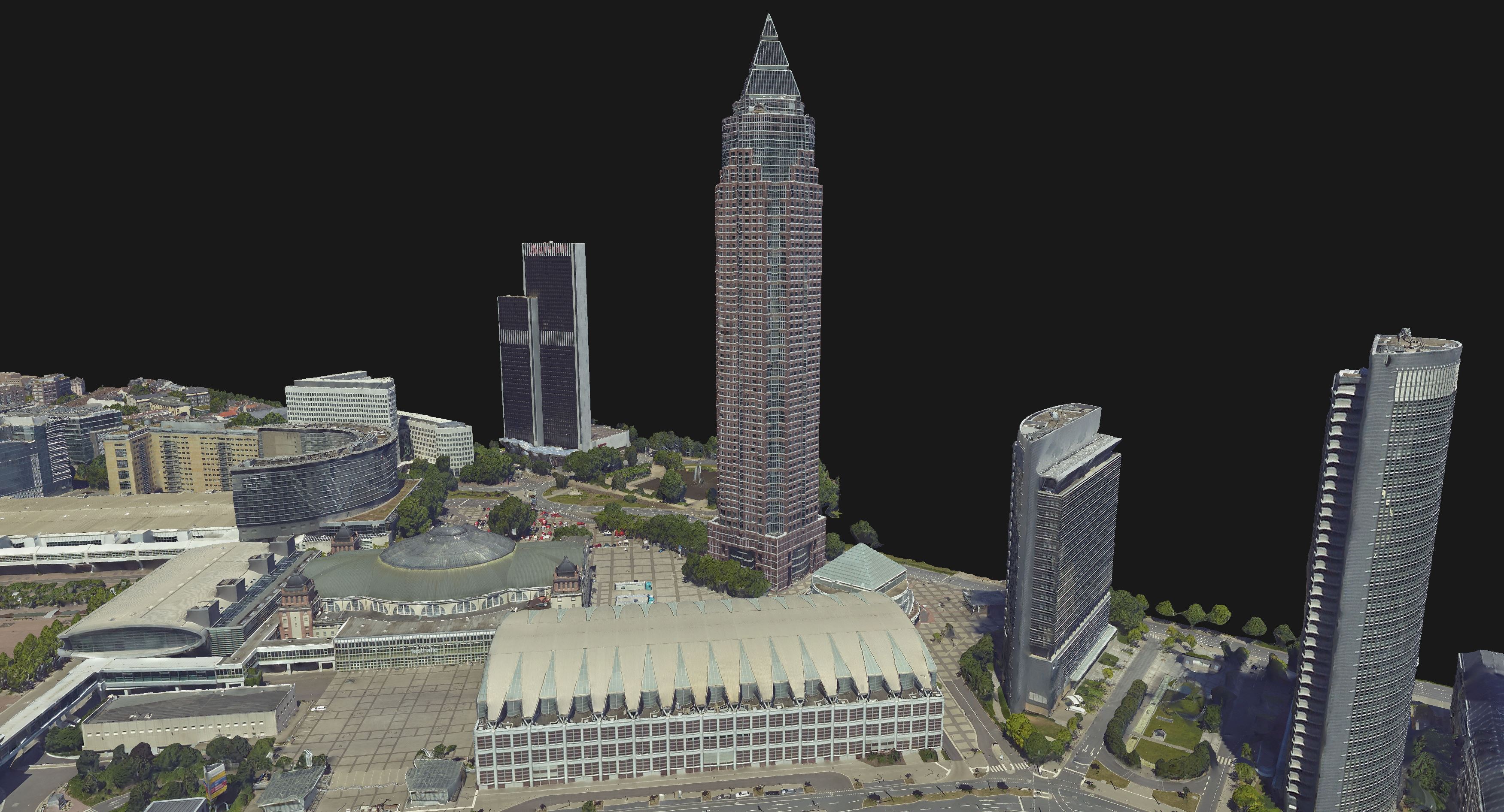
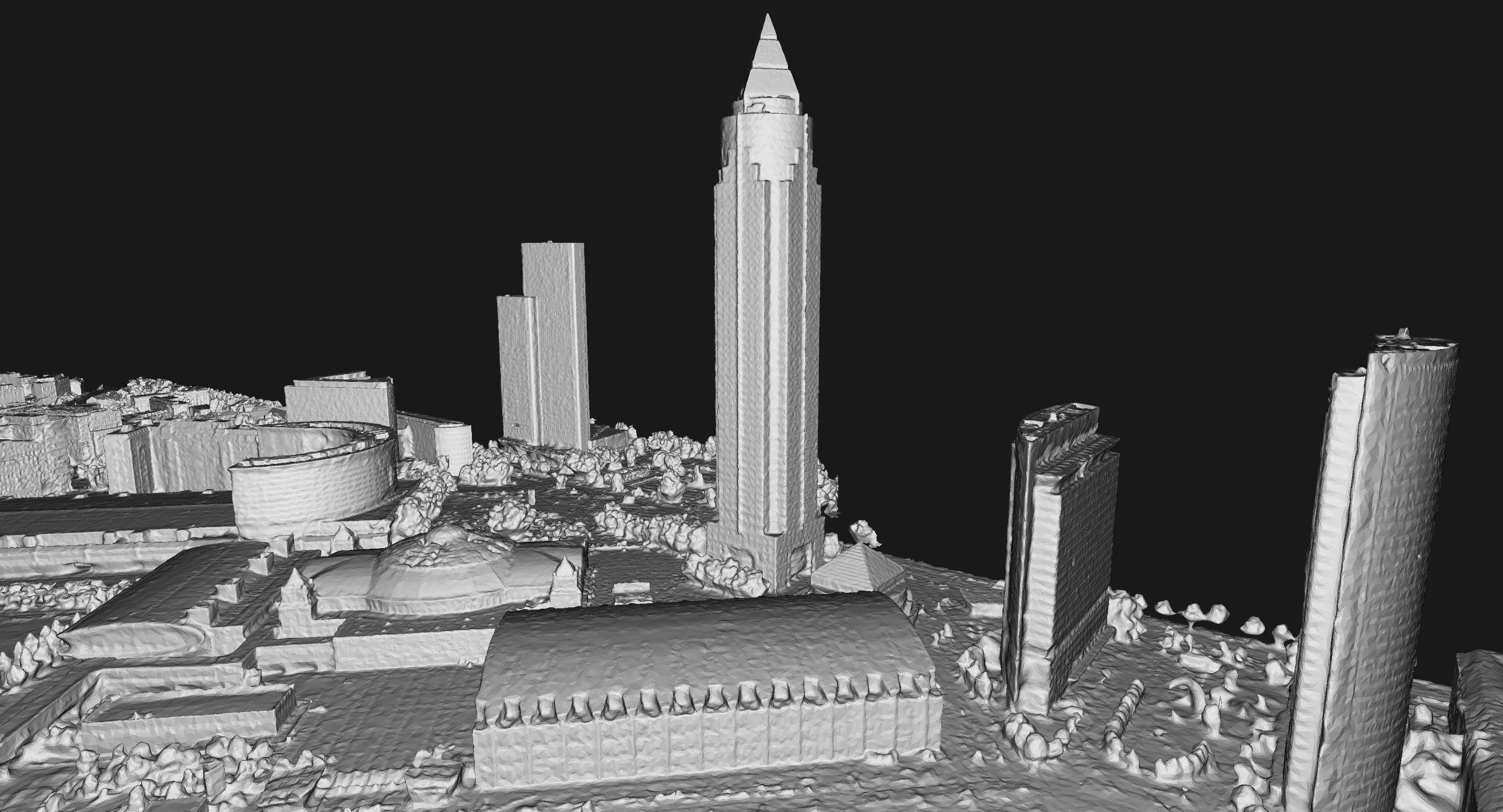
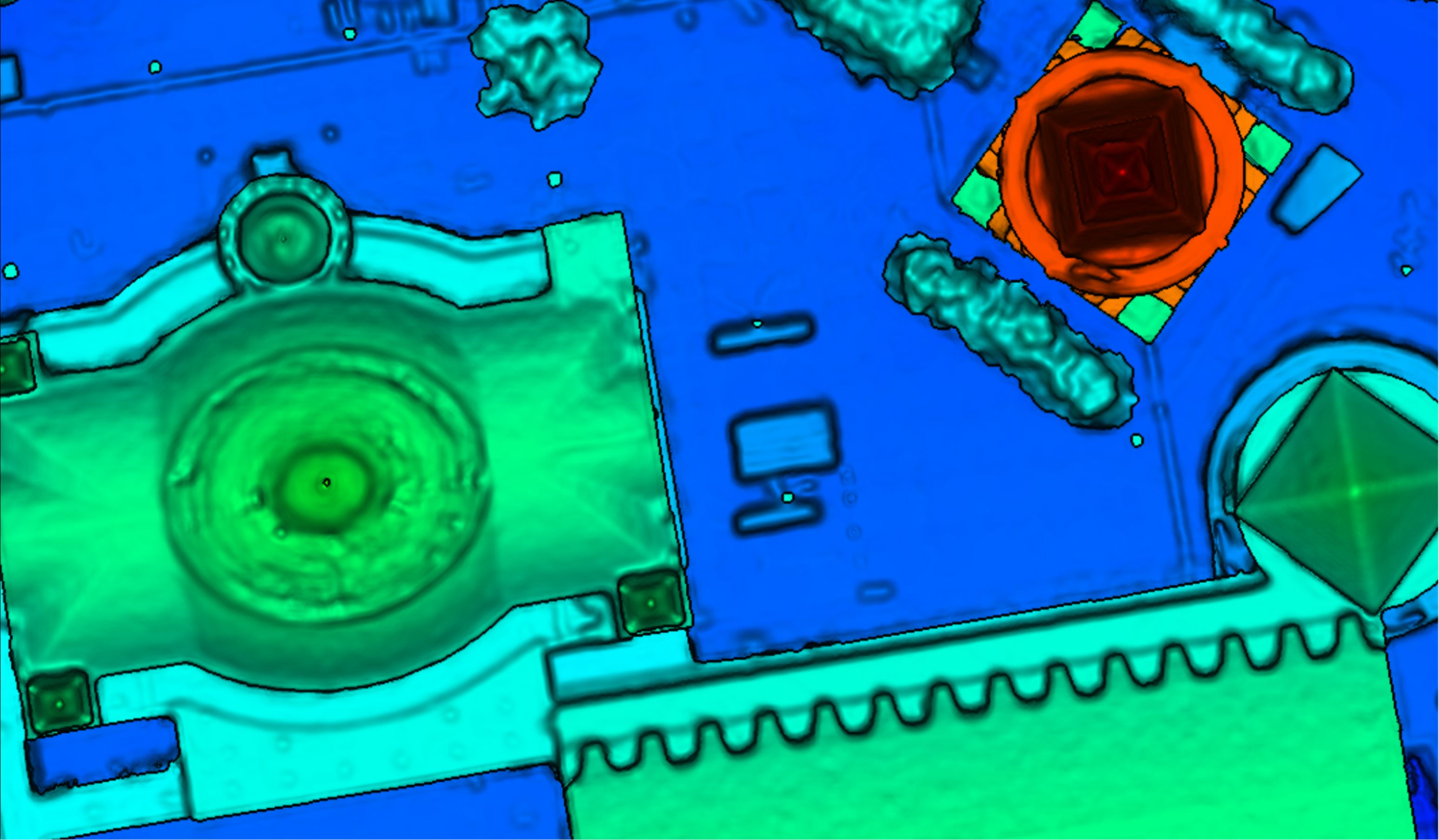
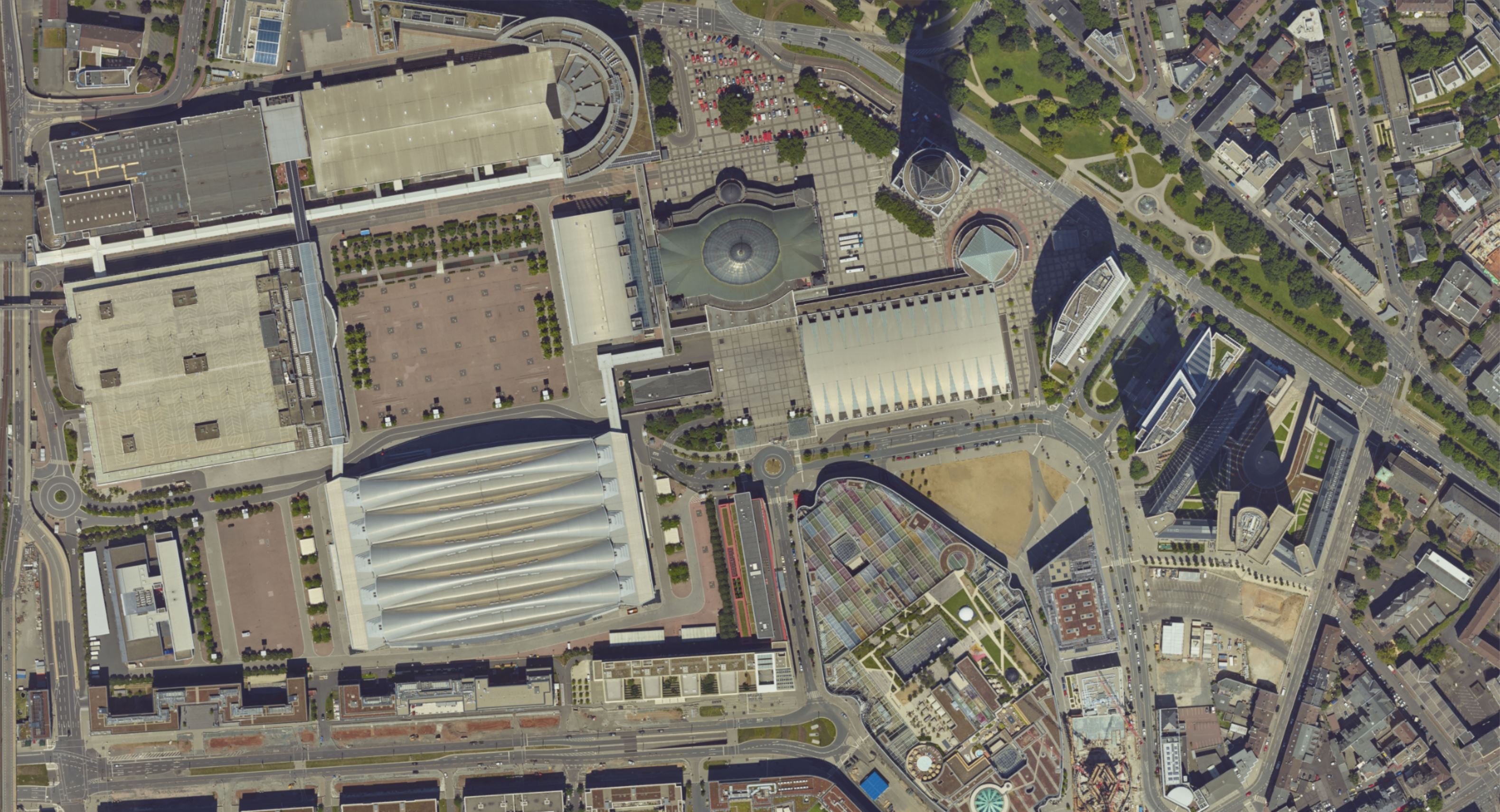
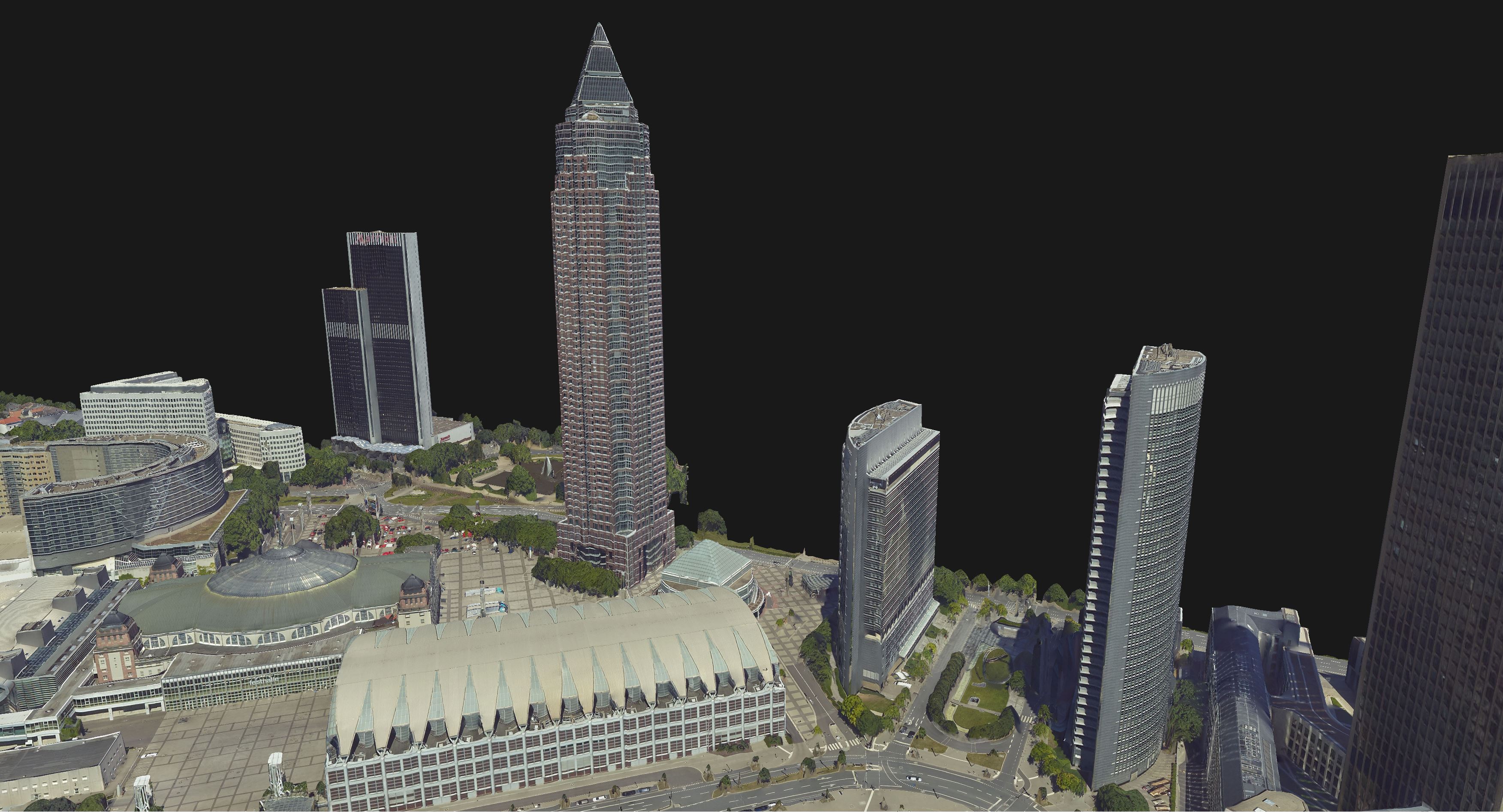
The 3D Mesh is an intuitive representation of the objects in 1:1 scale. Triangle faces are arranged to describe the geometry of the captured surface, carrying also texture information from the input images.
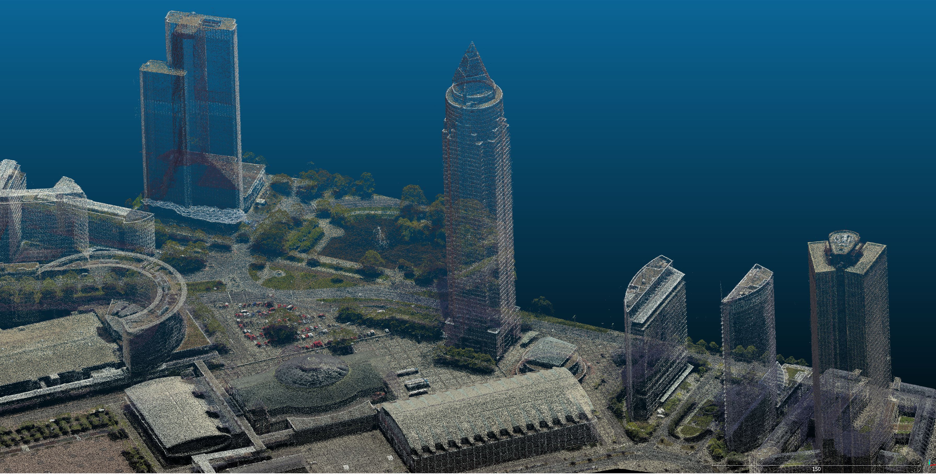
SURE can generate the 3D Mesh either from the filtered Dense Image Matching points only or in combination with LiDAR data.
Given its 3D nature, the Mesh preserves details on building facades and features under bridges, trees, or suspended structures. Straight edges, geometric accuracy, and photo-consistent texture determine the realistic aspect of the surface model when viewed from every angle.
The Mesh provides exceptional performance while loading or web streaming even large datasets. This is due to its optimized structure and organization of small files.
The various formats in which this product can be exported (OSGB, 3D TILES, SLPK, OBJ / LOCAL OBJ) allow for interaction with the models on Desktop applications and web-based 3D viewers.
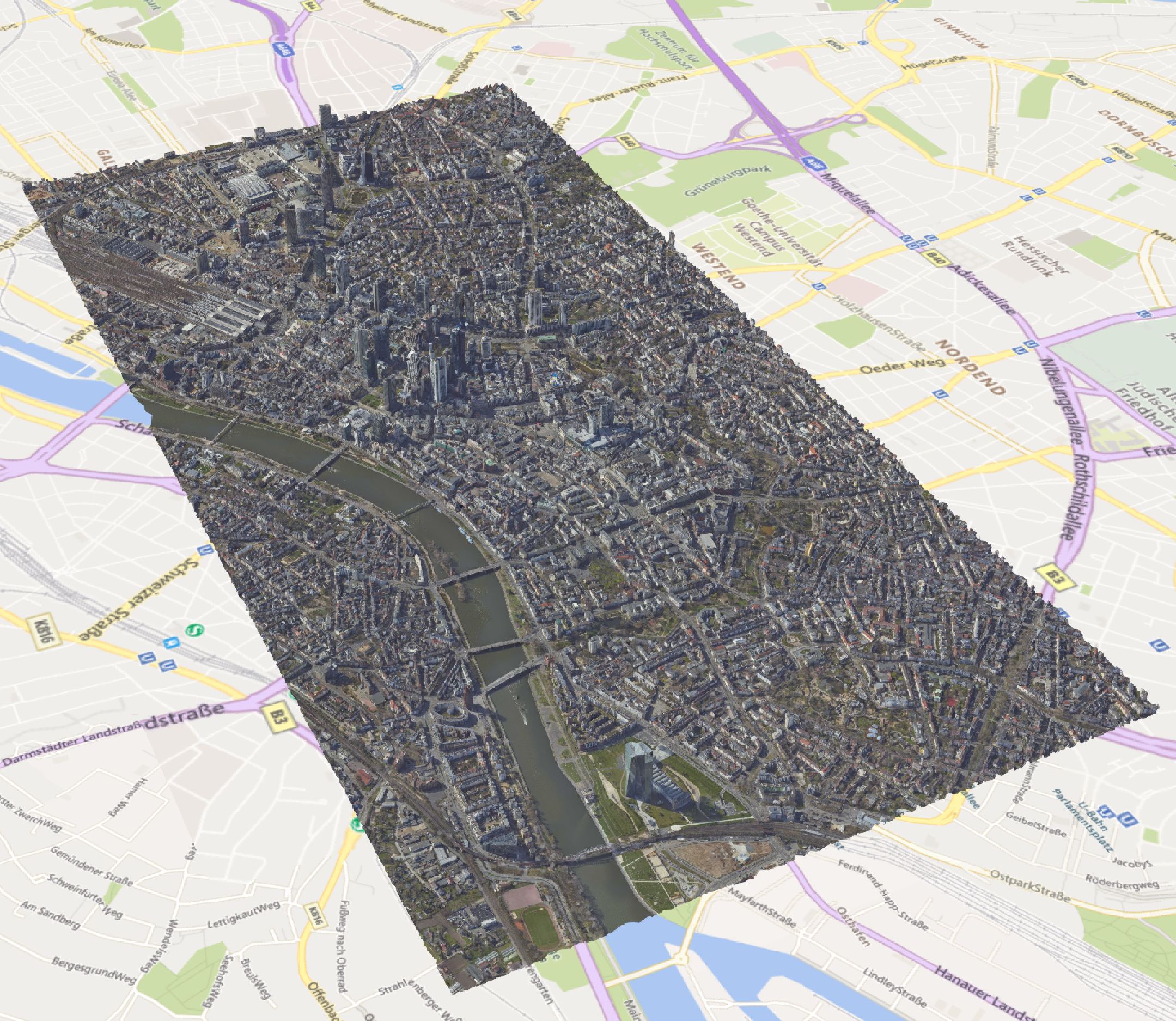
This type of output is facilitating various applications such as smart city planning and solutions, architectural visualization, cultural preservation, risk analysis, insurance industry, segmentation for feature extraction, etc.