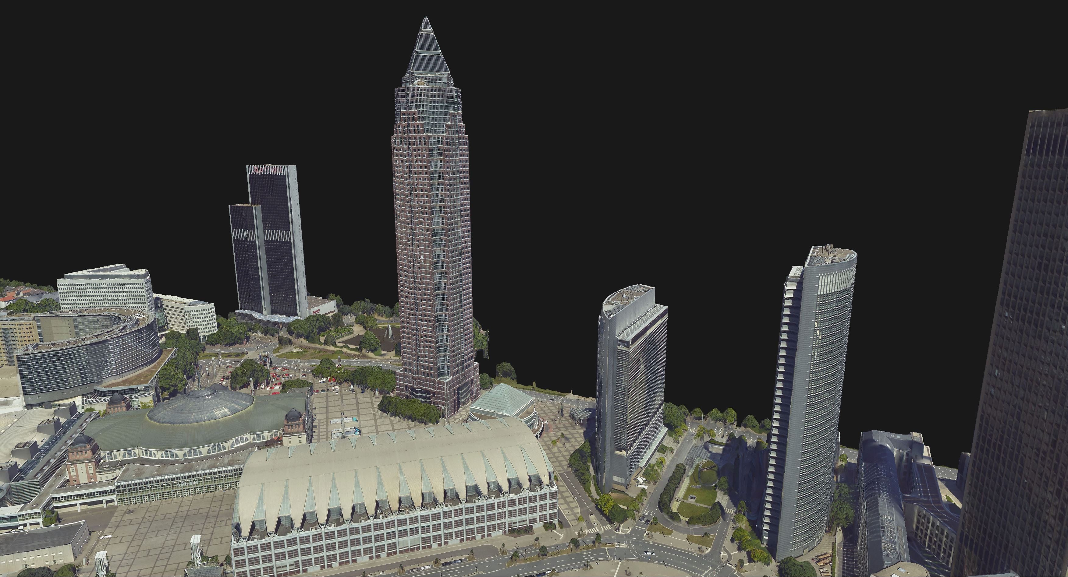
3D Point Cloud
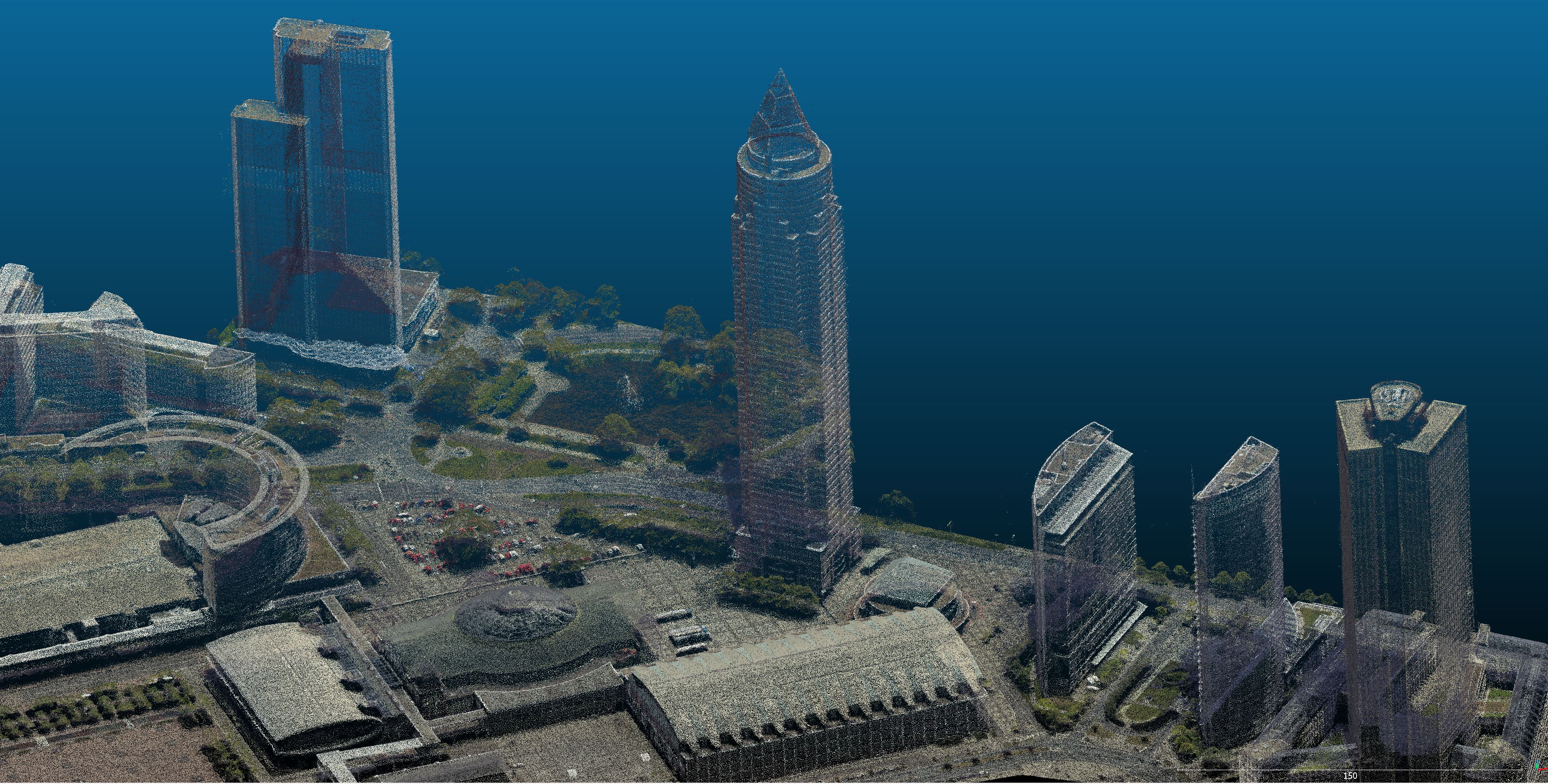
SURE Point Clouds represent an optimized outcome of Dense Image Matching. Each successfully matched pixel from the input images generates a 3D point, leading to a complete and dense surface reconstruction of the captured area. Subsequently, the point clouds undergo a filtering step, turning them into an accurate, light and noise reduced result.
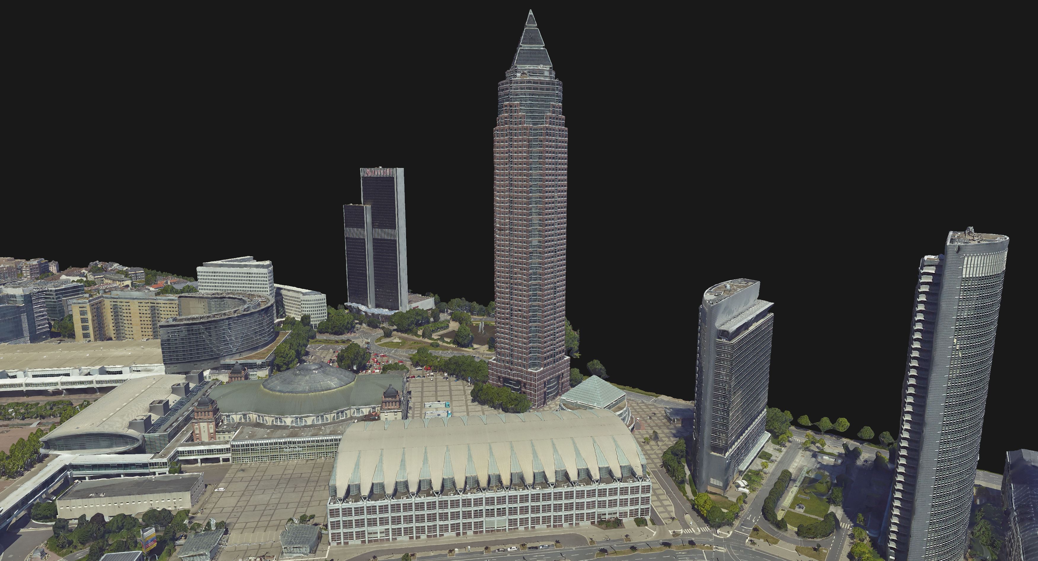
The special algorithms employed ensure the representation of captured objects with high detail and sharp edges, in a true 3D manner. Not only ground and rooftop information are accurately preserved, but also building facades, as well as thin structures.
Data are stored into small or manageable sized laz or las files. By default SURE writes the Point Clouds in the compressed laz format. The point clouds are colorized, as spectral information (typically RGB values) is transmitted from the images that produced the points initially. Apart from coordinates, the points store also meta-information relating to the positioning quality.
All these features make this product ready to use for applications such as: web streaming of city point clouds datasets, object extraction and classification, infrastructure modelling, etc.