True Orthophotos
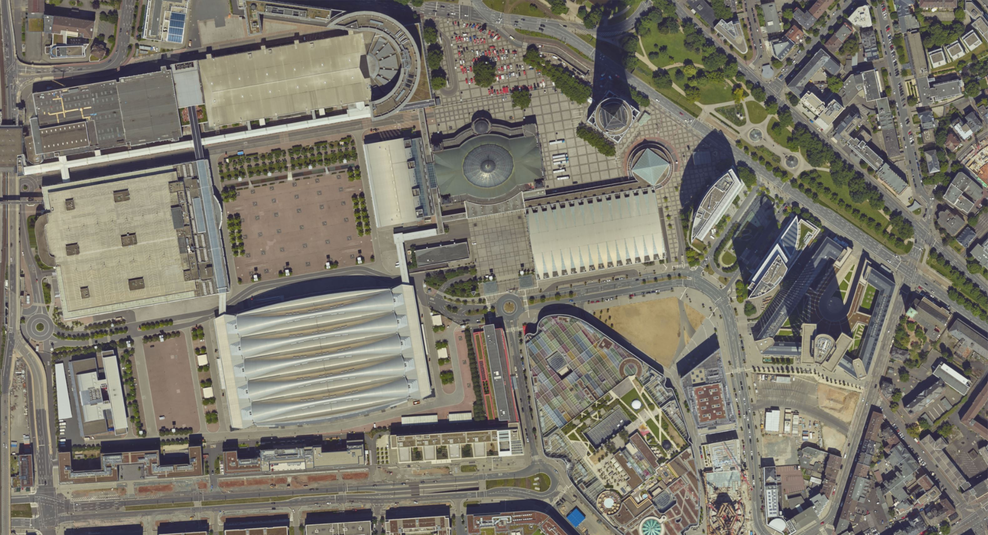
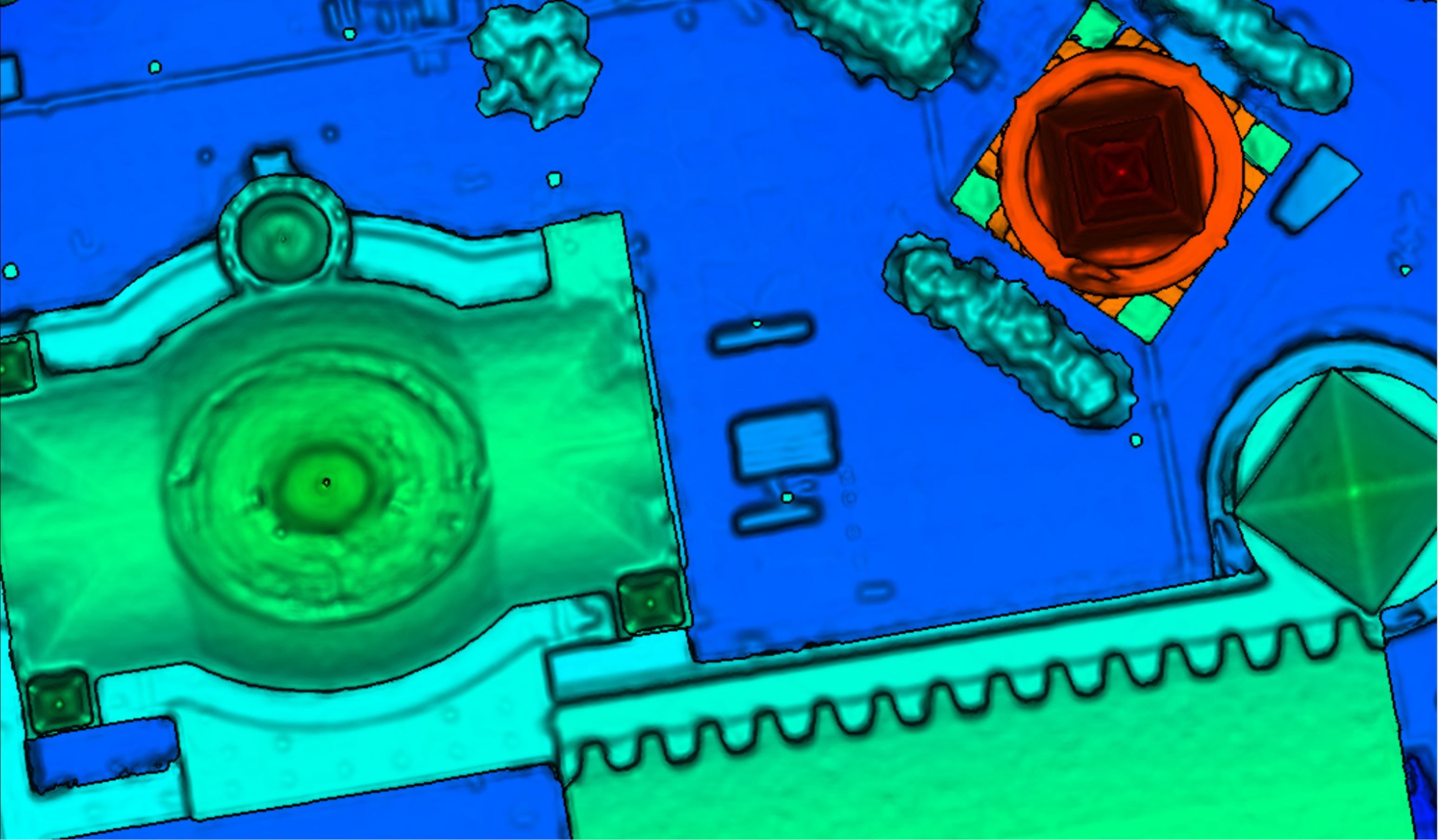
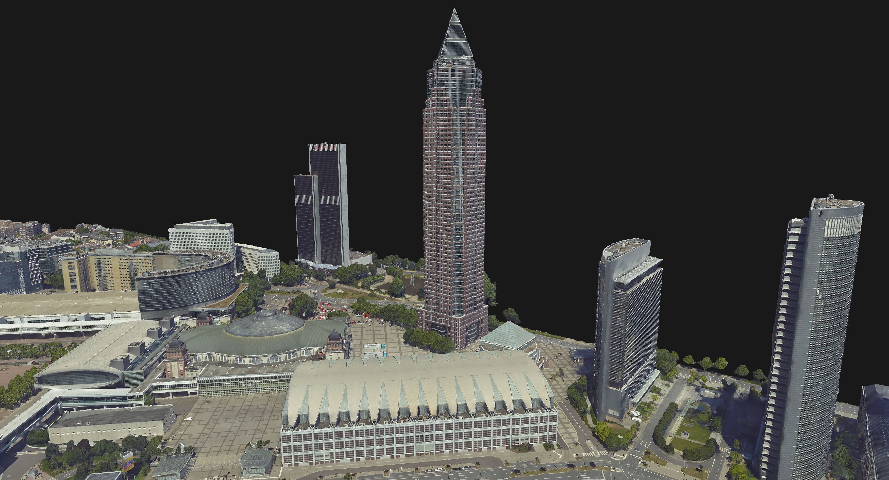
True Orthophotos (also known as True Ortho) show aerial images of the Earth surface and the objects on it in an orthographic projection. The images have the same bird's-eye view perspective as the DSM, depicting instead the original color bands of the input images. Up to 4 channels are supported, usually the Red, Green, Blue and -if available - the Near-Infrared bands.
The main feature that sets it apart from the classical Orthophoto is the use of an accurate DSM, instead of a DTM, as a geometric basis. This is applied to remove the perspective distortion of the aerial images. As consequence, a number of properties that distinguish the True Ortho from the aerial images and the classical Orthophoto emerge:
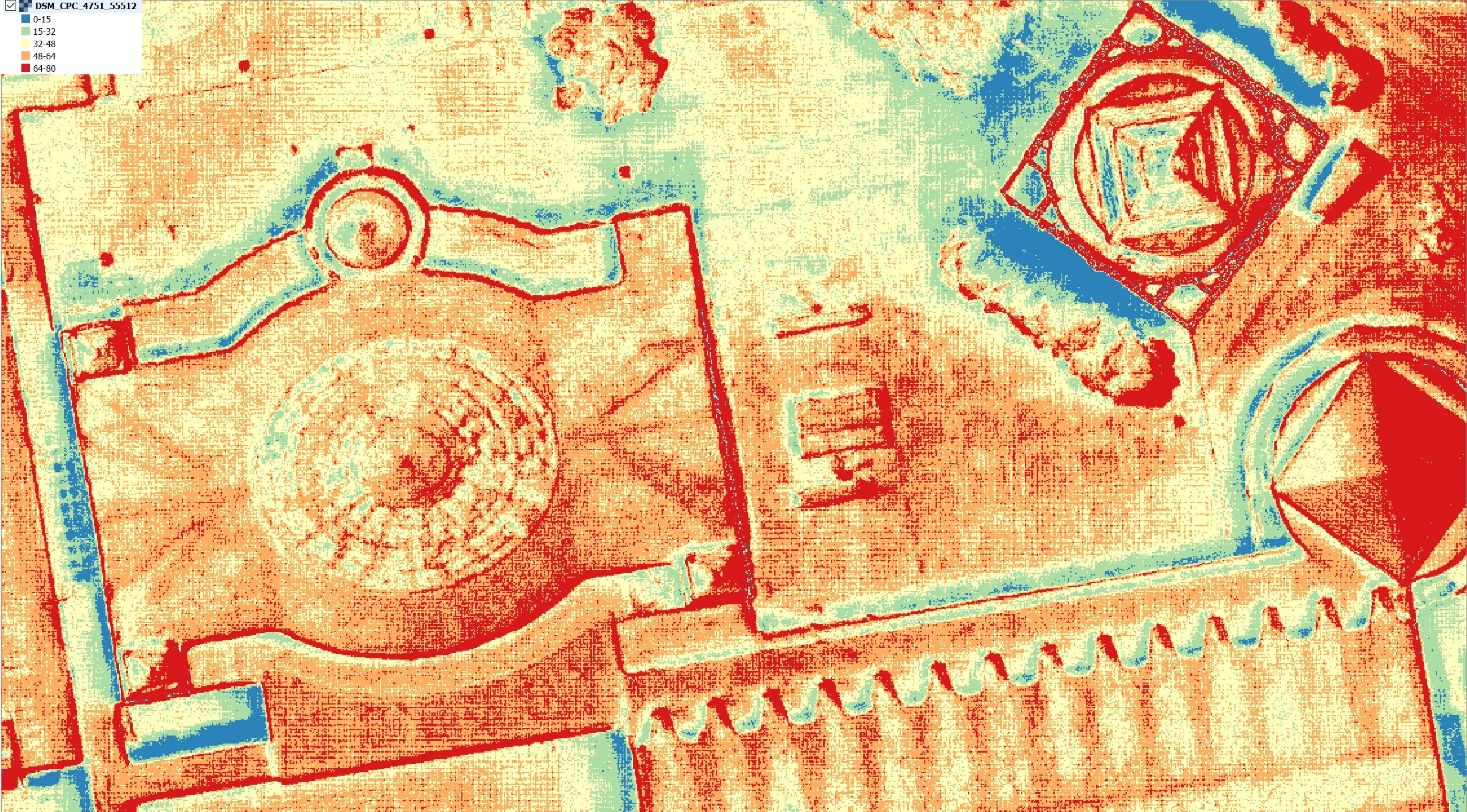
Uniform scale across the entire images. Size of pixels or resolution remains constant with regards to the object space that they cover. The resolution is identical to the one from the underlying DSM.
Accurate 2D positions of objects - with the possibility of georeferencing them.
True horizontal distances, independent from where they are measured across the True Ortho tiles.
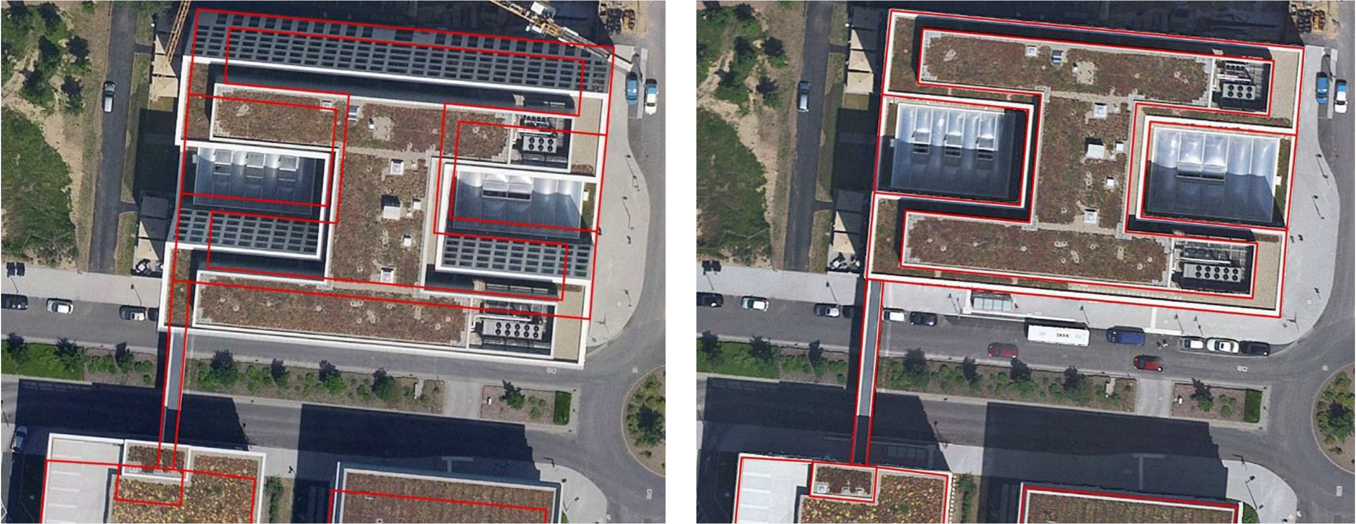
No displacement caused by relief or tall structures → no building lean and no occlusions caused by it.
Building footprints can be easily identified - consistent with rooftops, except for the eaves offset, where these are present.
Comparison between classical Ortho (left) and True Ortho (right) and the impact of Building Lean on the building footprints:
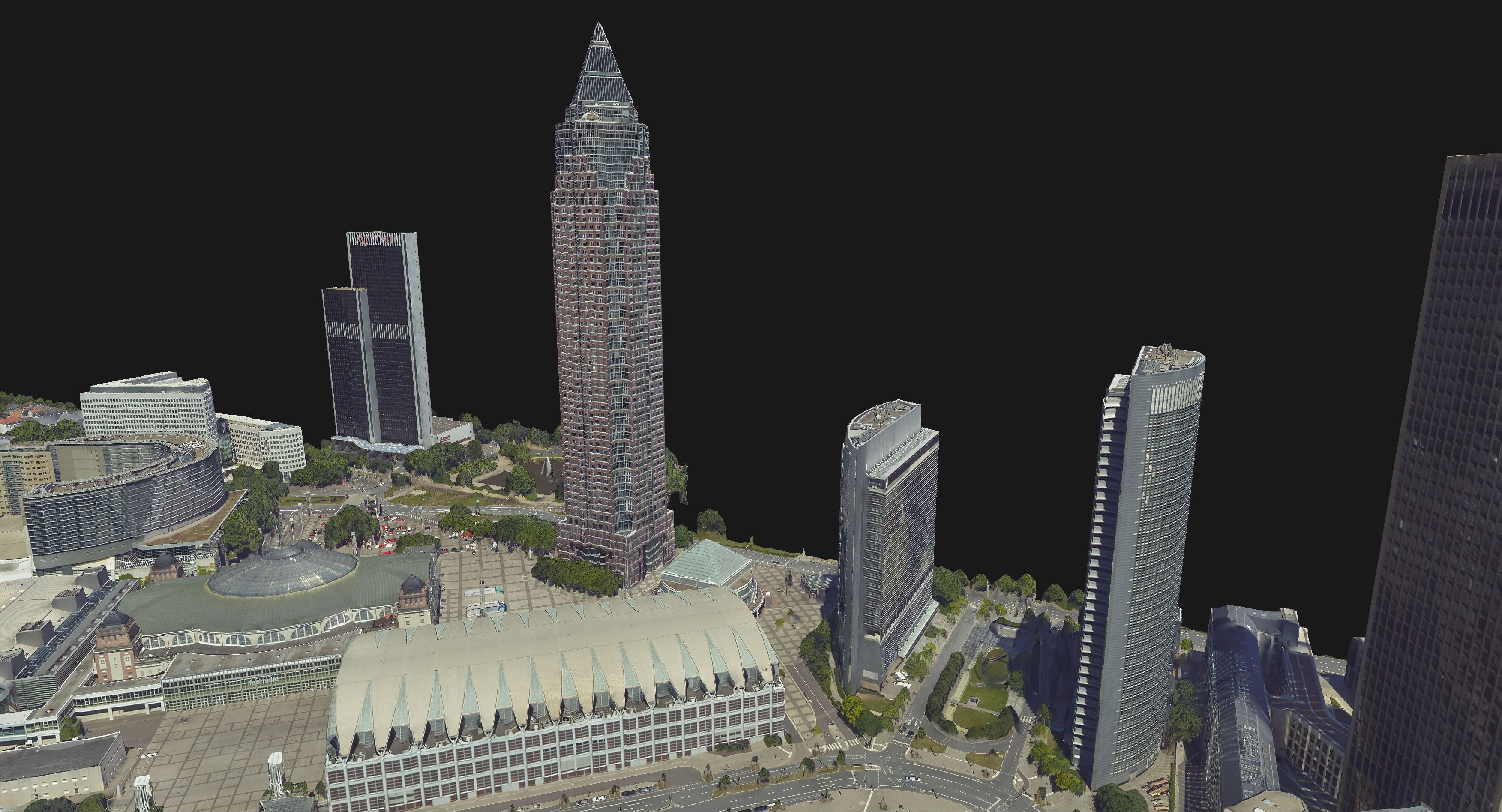
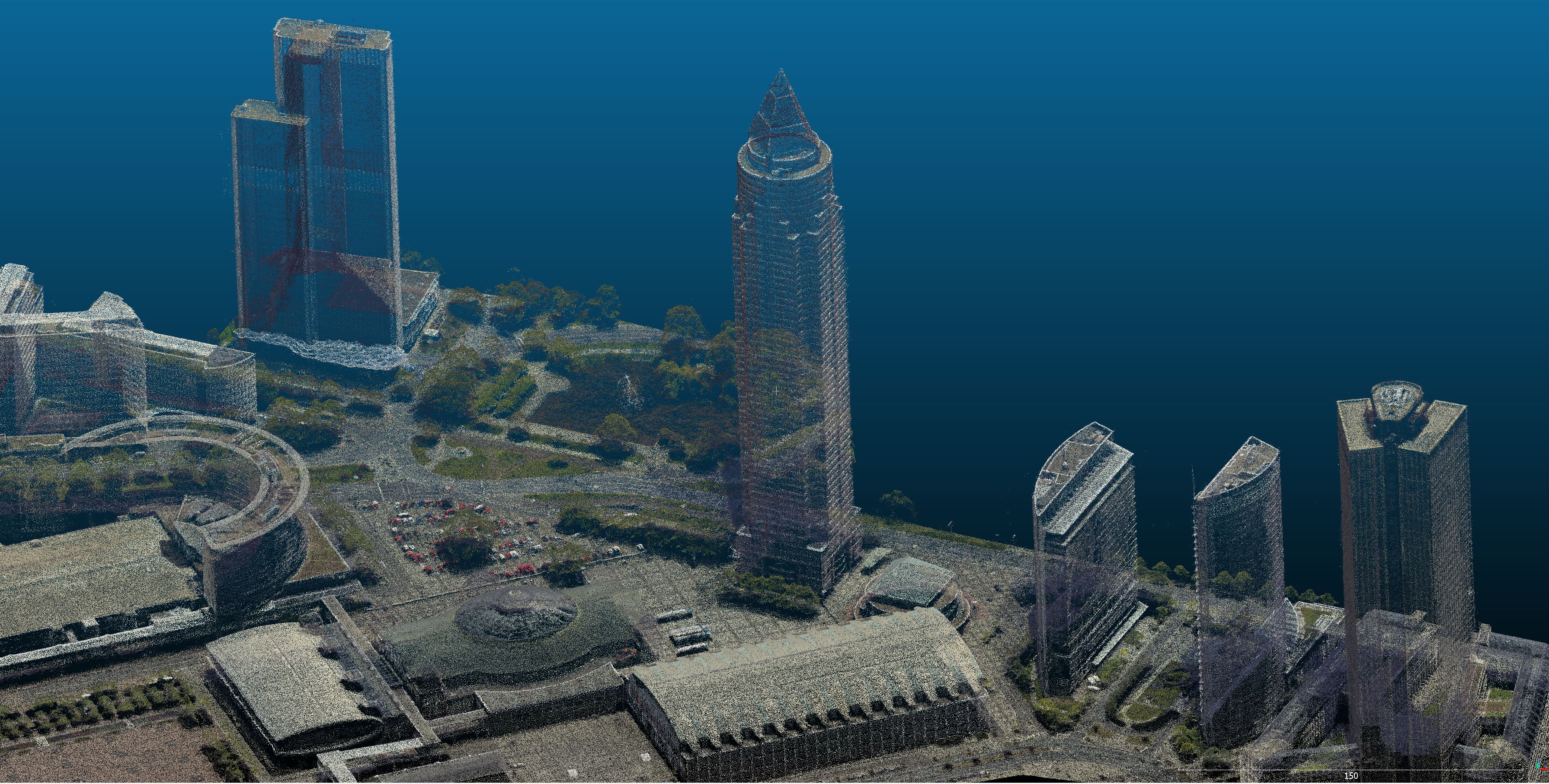
The True Ortho produced by SURE draws its strengths from the methods of data processing: the precise Dense Image Matching and the efficient DSM filtering produce well defined sharp edges, whereas the smart combination of images determine a crisp texture effect. Additionally, this product benefits from the Global Color Balancing feature, which evens out differences in color shades from the input images, caused by changing atmospheric conditions, camera exposure and orientation, etc. The unique algorithm producing the True Ortho does not imply a concept of cut lines or seam line editing, rendering the process as fully automatic. All these features make it a fit solution to represent both densely urbanized areas, as well as rural or natural landscapes.
True Orthophotos are the optimal base for mapping applications. They can be adopted as the most intuitive background for GIS operations. In the SURE package, the True Ortho comes together with the DSM. Therefore, applications can benefit from the combination of elevation and spectral data to accurately represent objects in real world. Examples where this particularly comes useful include Deep Learning based object detection, semantic segmentation, temporal analysis and others.