What's new in SURE 2.3
data: courtesy of Aerowest
Introducing SURE 2.3
Radically boosting photogrammetric productivity with the most powerful SURE Software release to date!
Deliver amazing 3D meshes, point clouds and True Orthos timely, with enhanced capabilities for more flexible processing and product delivery.
New Features
Automatically split & distribute sub-projects to computer clusters for maximum performance
- Fully automatic network cluster setup
- Automatic workload distribution to finalize projects in a much shorter time-frame
- Retrieve complete results for sub-areas faster for parallel Q&A & delivery
- Flexibly scale processing capacity by adding/renting additional licenses - even while processing has already started
- Monitor overall project progress and instantly inspect deliverables as nodes complete each sub-project
- Find a step-by-step instructions on how to set up a Distributed Processing project and more
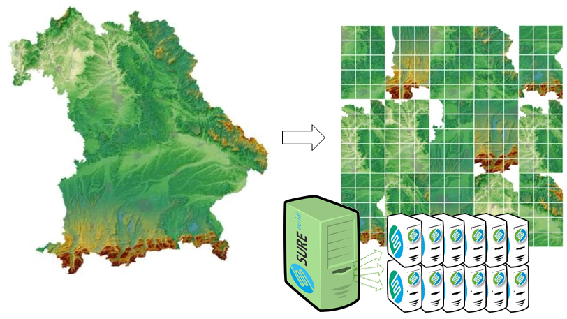
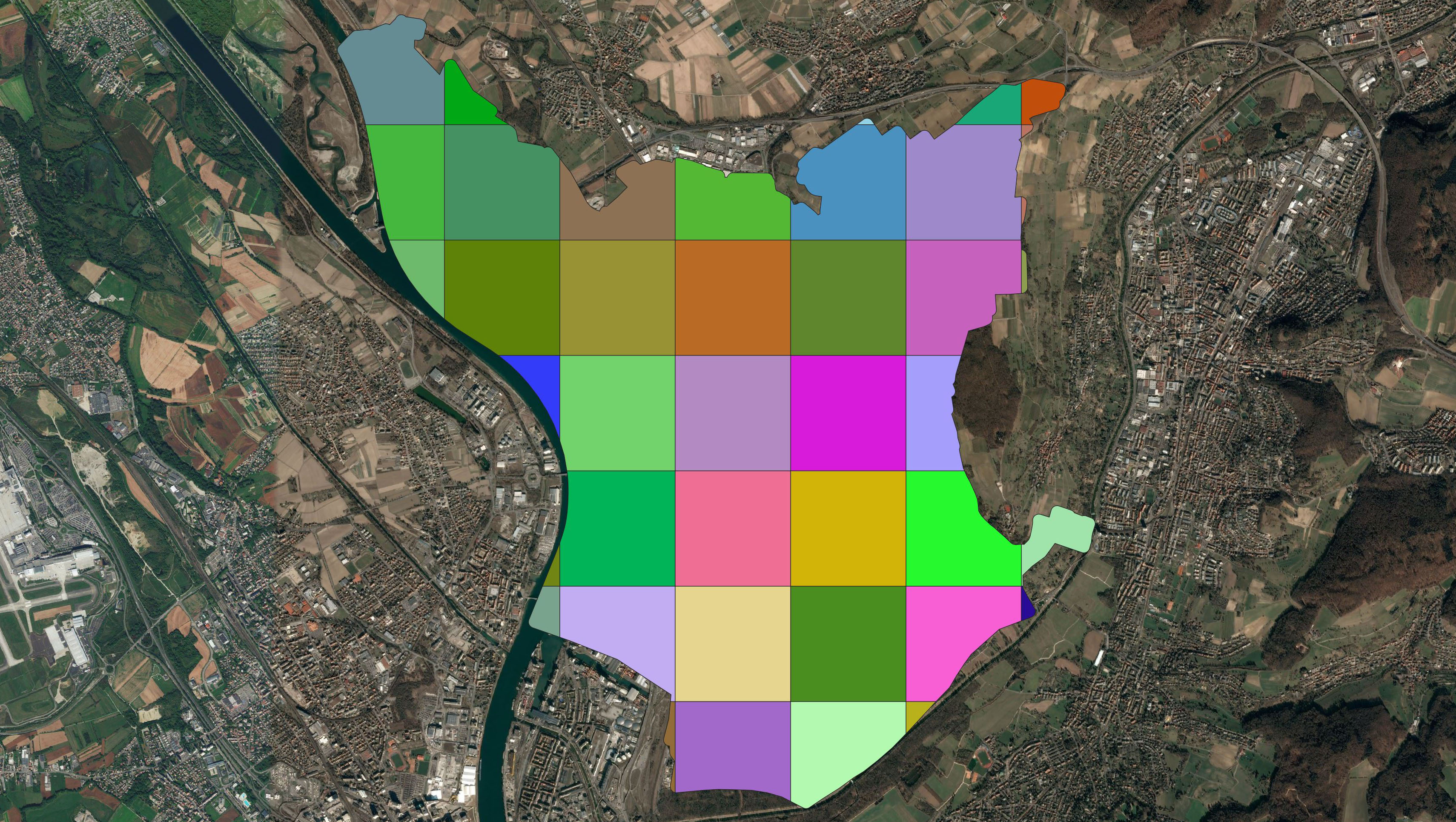
*SURE processing area automatically splitted into sub-projects for distributed processing
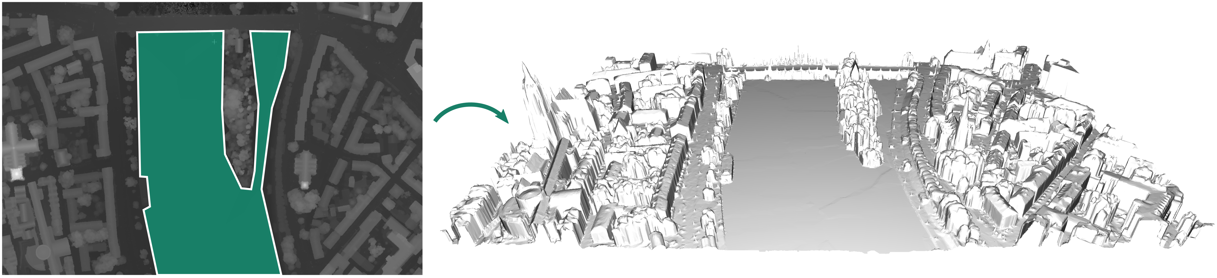
Define complex regions of interest using shape file polygons
- Immediate cutting of outputs such as DSMs, Point Clouds, True Orthos and Meshes
- Reduction of processing time and storage requirements
- Support of shape files with multiple polygons and inner rings
- Mask out areas for compliance (e.g. military zones)
- See this article for more detailed information
Introduce shape file surfaces - such as leveled water bodies
- Insert flat surfaces through shape files - e.g. for water, bridges or any custom 2.5D planar shape
- Height values interpolated from xyz shape vertices
- Automatically impacts 2.5D and 3D products - including Point Cloud, DSM, True Ortho and Meshes
- Eliminate manual effort of time consuming interactive clean up
- Projects with larger water bodies are processed considerably faster
- Supports multiple polygons within a shape file
- For a complete tutorial, please refer to this article
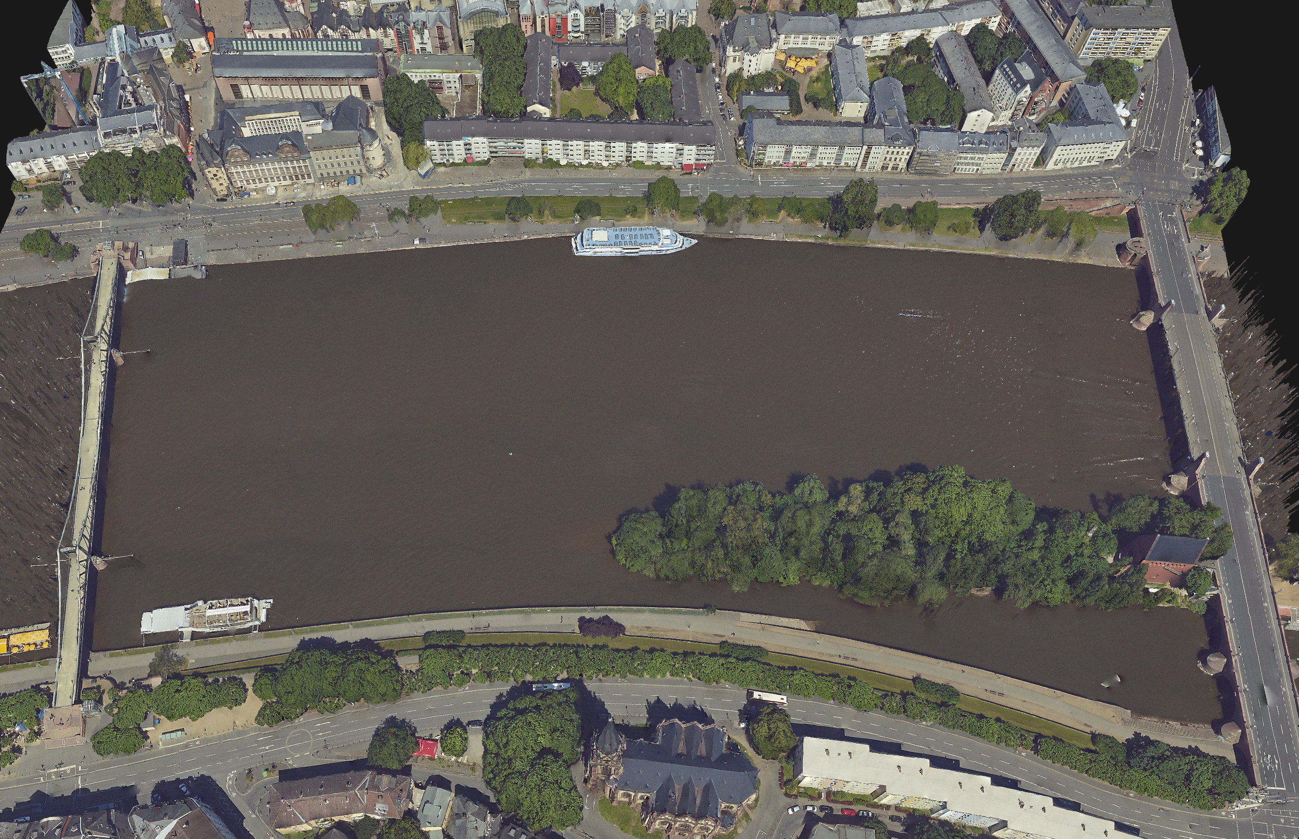
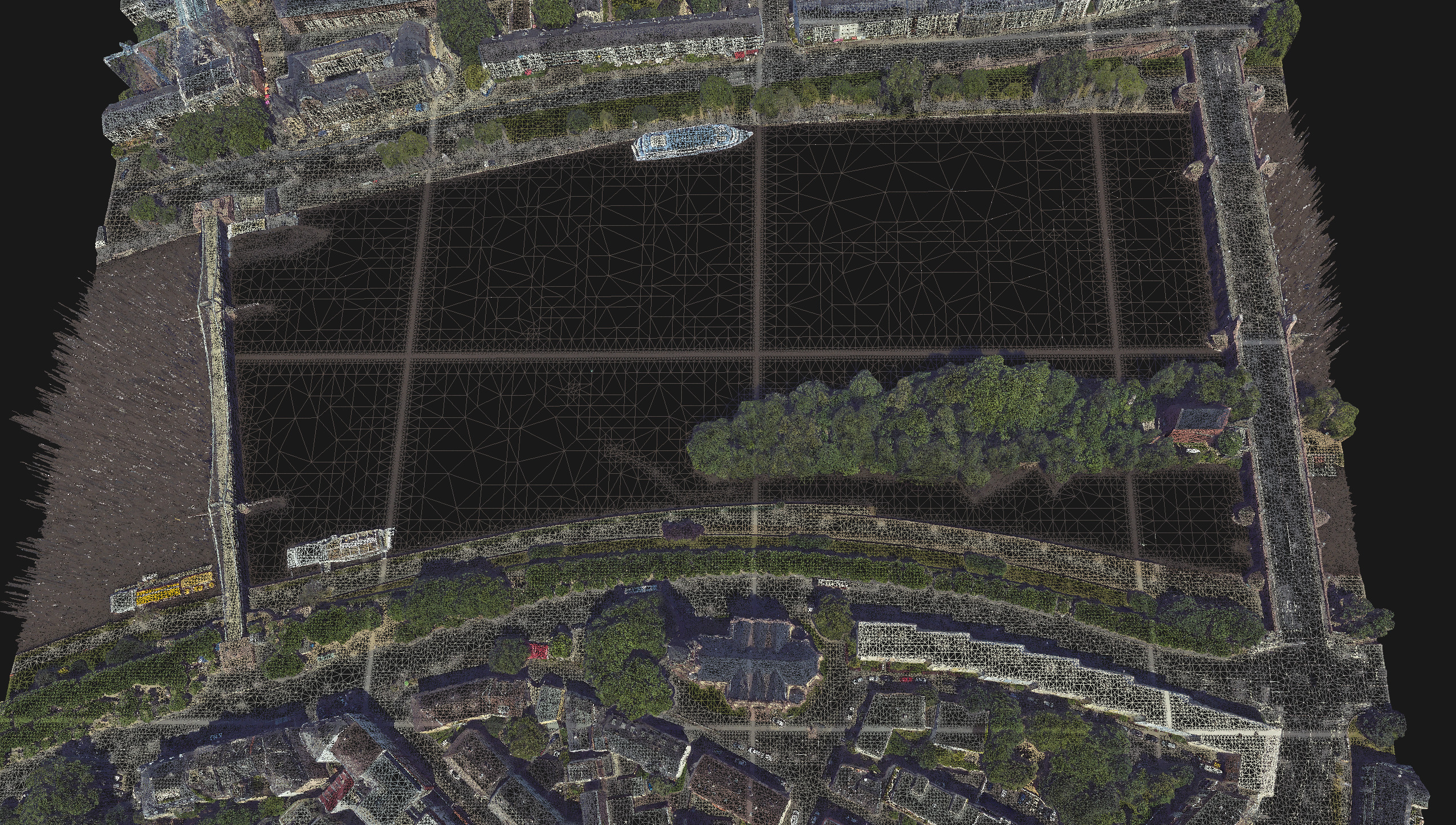
Shape file, flattened DSM and mesh result (data courtesy of Aerowest)
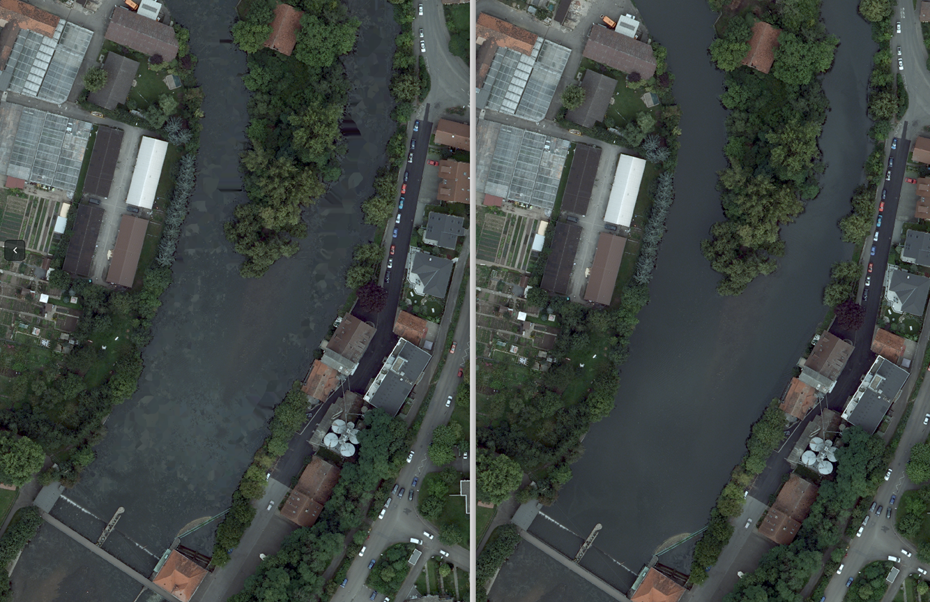
True Ortho without and with water body shapefile
Supporting new data standards and 3rd party mesh-viewers
- OpenSceneGraph (.osgb)
- Cesium Tileset for web streaming
- New: Fastertexturing of the Cesium Mesh
- New: Cesium height reference definition
- Collada (.dae) with XML based LODTreeFormat (e.g. for Agency9 CITYPLANNER)
- Wavefront (.obj) with or without XML based LODTreeFormat
- See the full list of supported output formats
Simultaneous writing of multiple formats during processing

Define project coordinate system and propagate it to all outputs
- Define WKT string in project settings
- Retrieve georeferenced output with coordinate system information (e.g. geotif, point clouds or Cesium meshes)
- For more detailed information please refer to this article
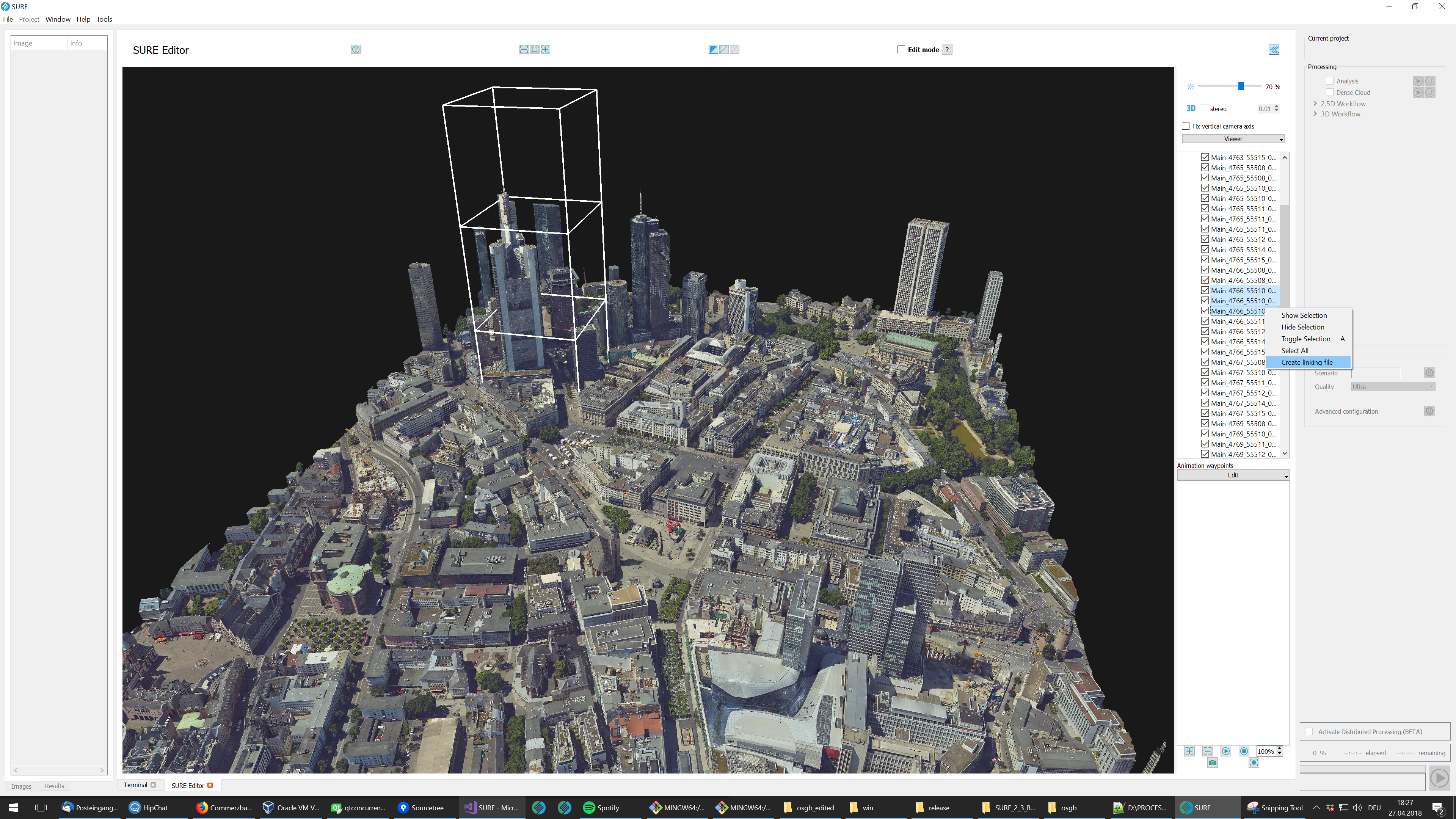
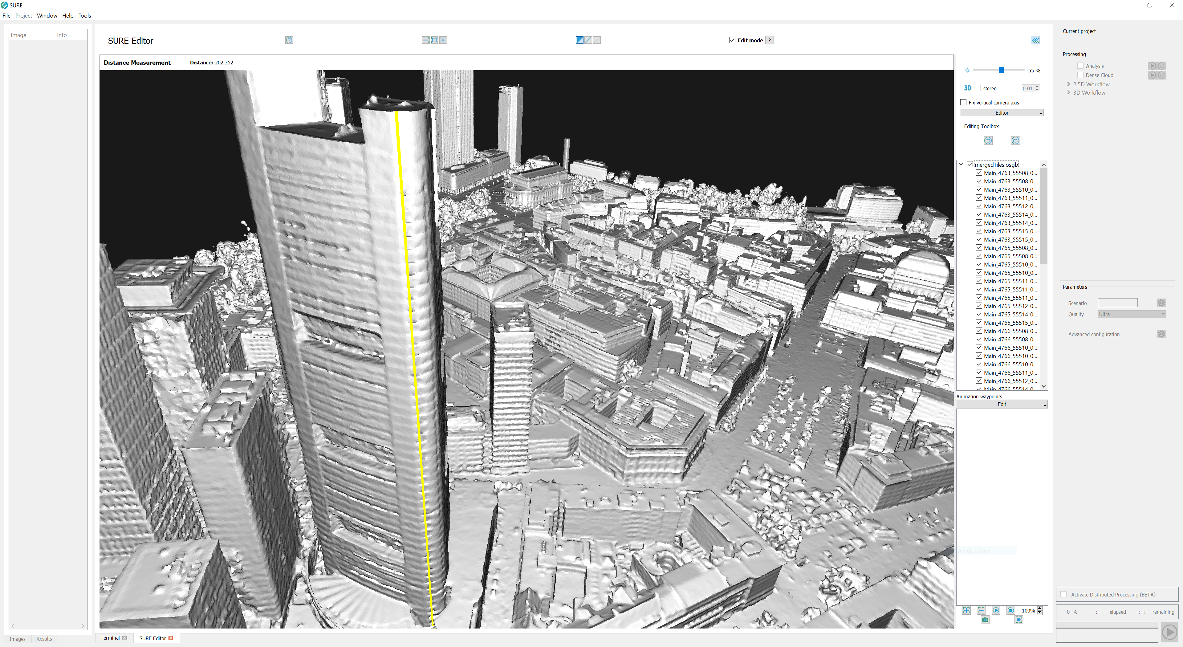
SURE Editor release - facilitating a smooth workflow
- Combine and export meshes
- Create new main linking file for selected tiles
- Edit meshes while streaming from hard disk
- Efficient loading and editing of entire cities without delay
- Edit meshes and retexture changed regions only
- Retrieve DSM and True Ortho from edited mesh
- Undo and redo
- Tools
- Peak removal
- Polygon flattening
- Edge sharpening
- Spherical eraser
- New tools and improvements
- Snap to vertices of triangles to simplify edge sharpening
- Measure length along line segments and polygons
- Get names of tiles and point coordinates
- New display options with right-click context menu
- Highlight selected tiles.
- Hide and toggle mesh visualization.
Improvements
Read and write TIFF files that are compliant to authority standards and 3rd party workflows.
- Tiled TIFF, image pyramids, compression* and BigTIFF supports processing massive projects faster with fewer demanding hardware requirements.
- GeoTIFF - Geotags inside TIFF files
- DSM images and True Ortho images are now written in GeoTIFF format.
- TIFF World files
- *.tfw files can be stored to accompany each TIFF file.
- Production can be enabled/disabled in Project Parametrization.
- Image Pyramids/Overviews
- All TIFF files include by default image pyramids for efficient image access and display.
- To save disk-space, image pyramids can be turned off in Project Parametrization.
- Tiled TIFF
- Tiled-wise organized TIFF imagery is accessed more efficiently compared to non-tiled Tiffs that fill-up processing memory with the whole image content.
- Writing of tiled TIFF is always activated
- No data value convention
- Image pixels may be written with a NODATA tag. GIS software leverages a specific value (e.g. NaN) to be interpreted as a pixel with missing data.
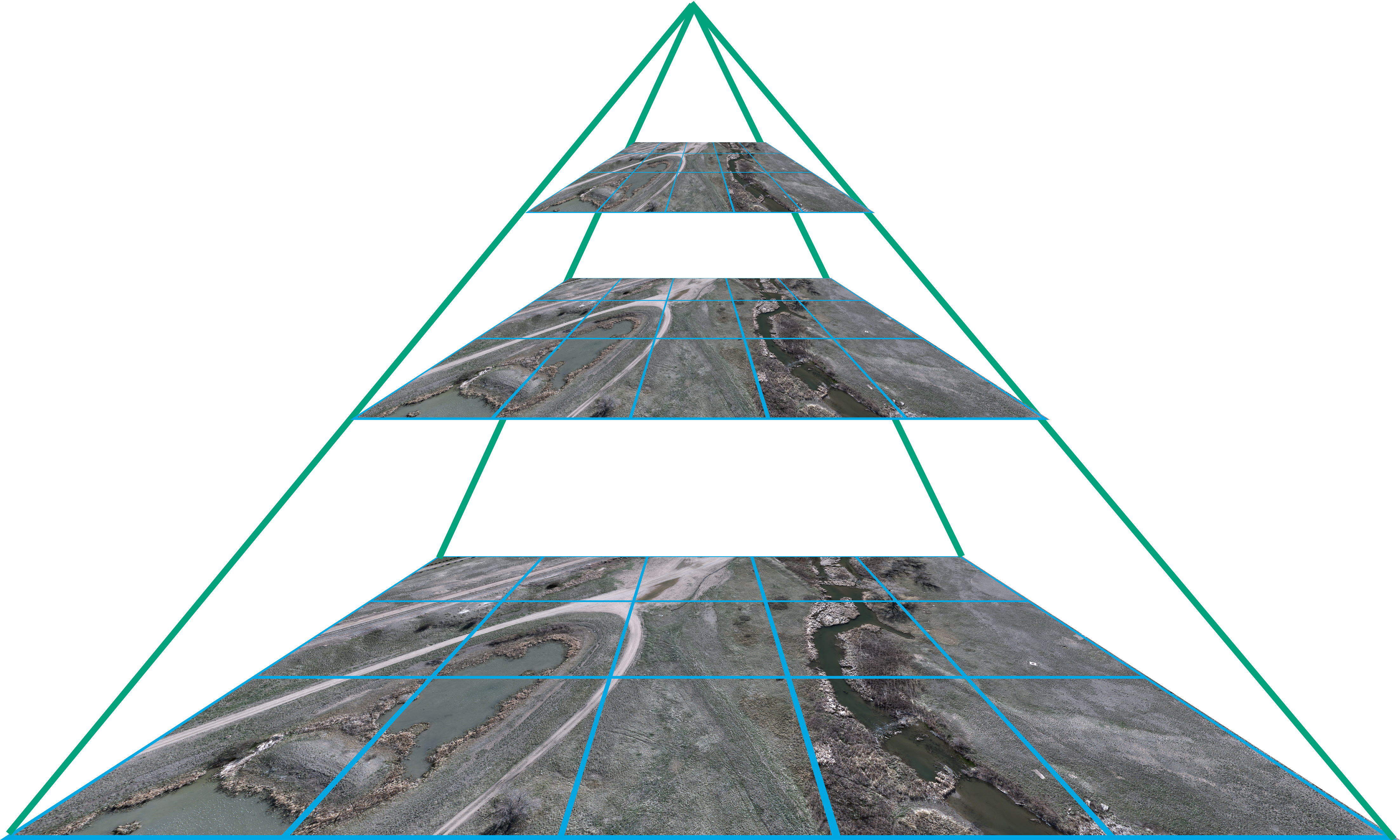
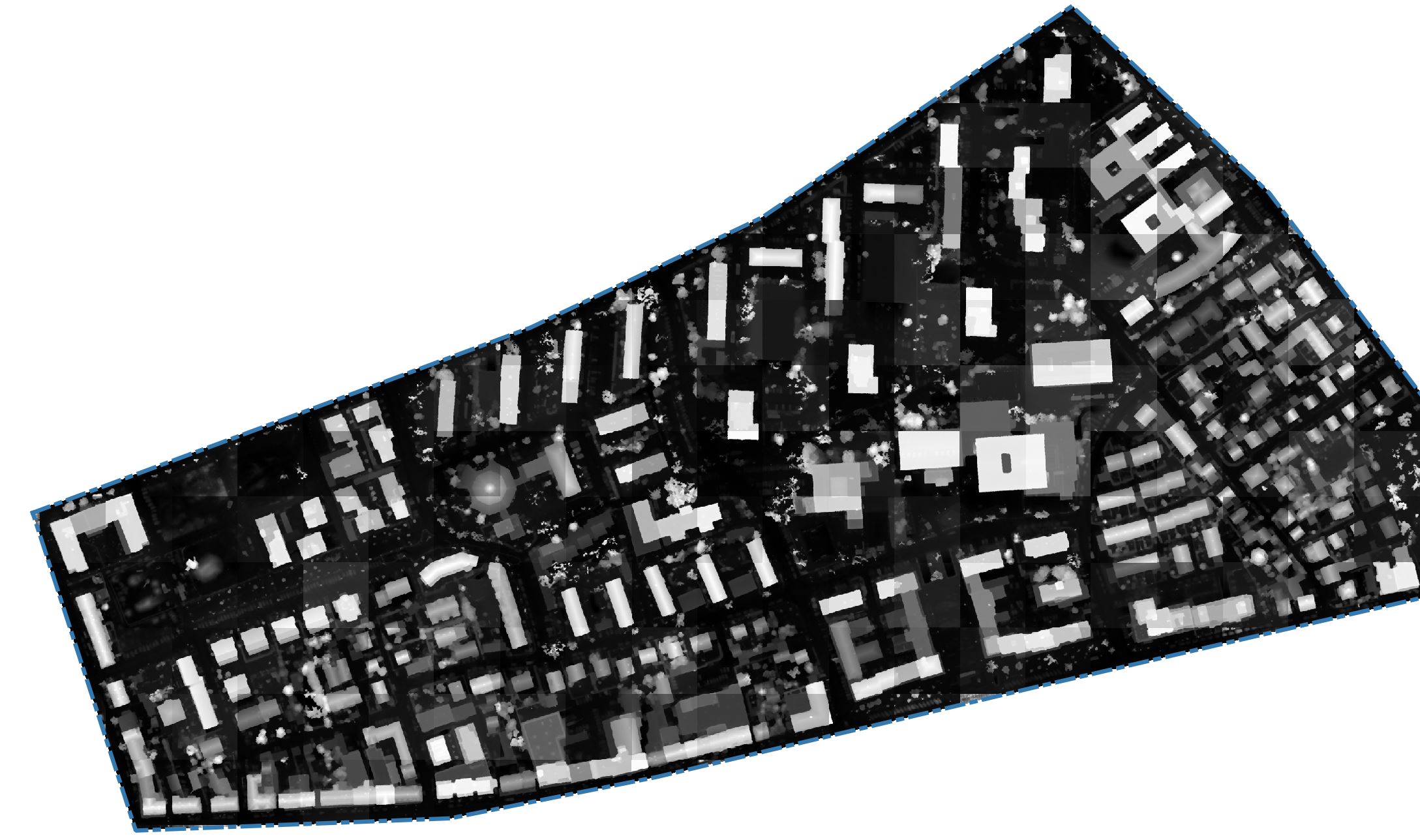
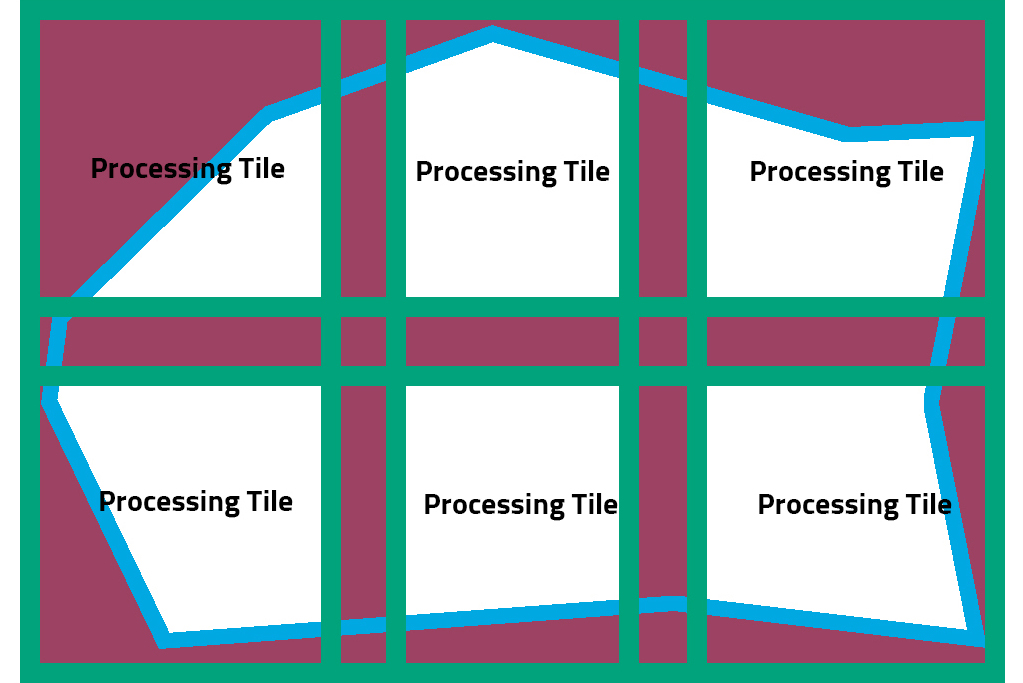
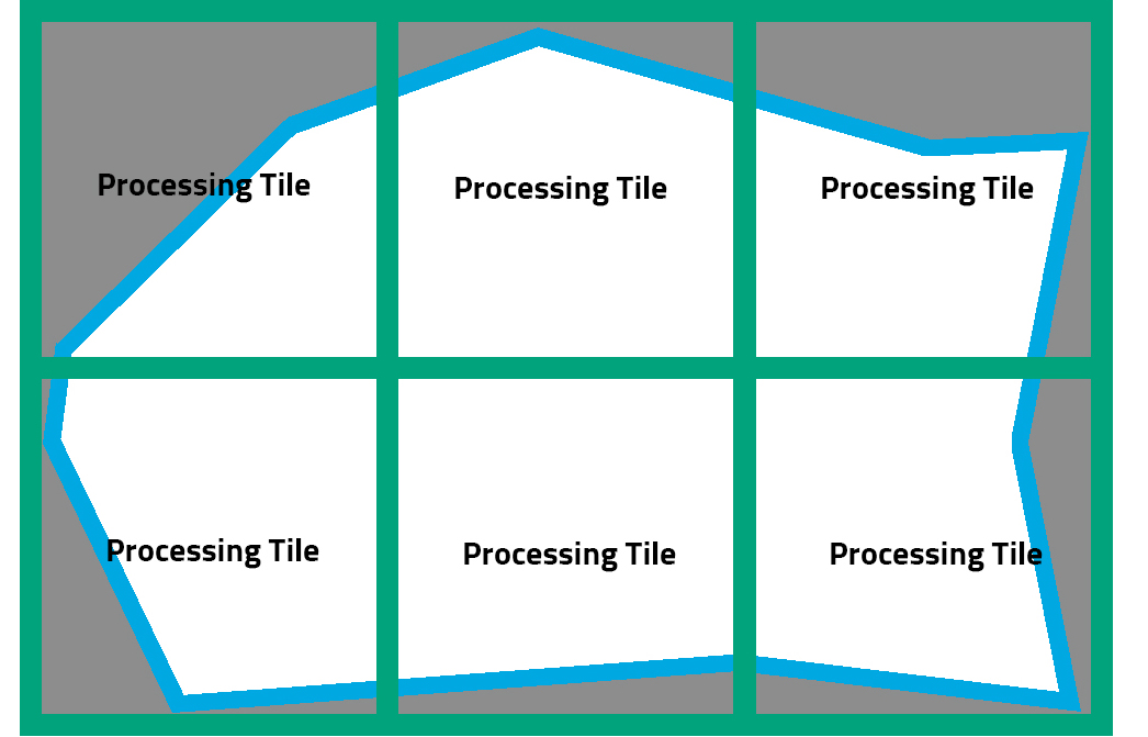
Process neighboring sub-projects with consistent borders
- Automatic adaptive padding and masking area around each project
- All neighboring projects are consistent and are perfectly aligned.
- No more need to define sub-projects with overlap (left graphics), therefore less redundant information to be stored.
- Refer to this page for more information
A Reduction of obsolete intermediate files for an easier to handle file structure.
- Much simpler organization of files and projects
- Less data to archive and to clean-up.
Workflow updates
- The parameter allowing for production of *.gtif output doesn't exist anymore in user interfaces and command-line interfaces, SURE is generating GeoTIFF tags instead.
- New parameters are added to the user interface and command-linie interface controlling the production of TIFF world files and Image Pyramids
- Either specify the area of interest within a bounding box or alternatively load polygons for more complex definitions.
- Use polygons to generate smooth water surfaces in 2.5D and 3D. Hint: water-body filtering is only one use-case for the functionality. In a 2.5D workflow (e.g. true-orthos) this tool might also be used to fill the space between buildings in narrow streets with points generated from the height of polygon vertices.
- Pass through projection information (WKT-Strings) throughout the complete processing chain also.
Deprecated
- *.gtif format is no longer produced by SURE.
- SURE Pro is no longer controlled through the command line interface.