Region of Interest
Defining a Region of Interest helps speed up the production process and makes sure that results are generated only within areas that are fully covered by the provided imagery. SURE also uses this information for processing only those images contributing to the final result.
There are two ways of specifying the SURE Project Area:
2D Area Shapefile
Z-Range
Note: If an Area Shapefile is not specified, SURE will by default generate an Automatic Area Shapefile. This Shapefile delimits the area where high quality results can be expected based on the input data. Users can disable this feature from the Advanced Configuration panel.
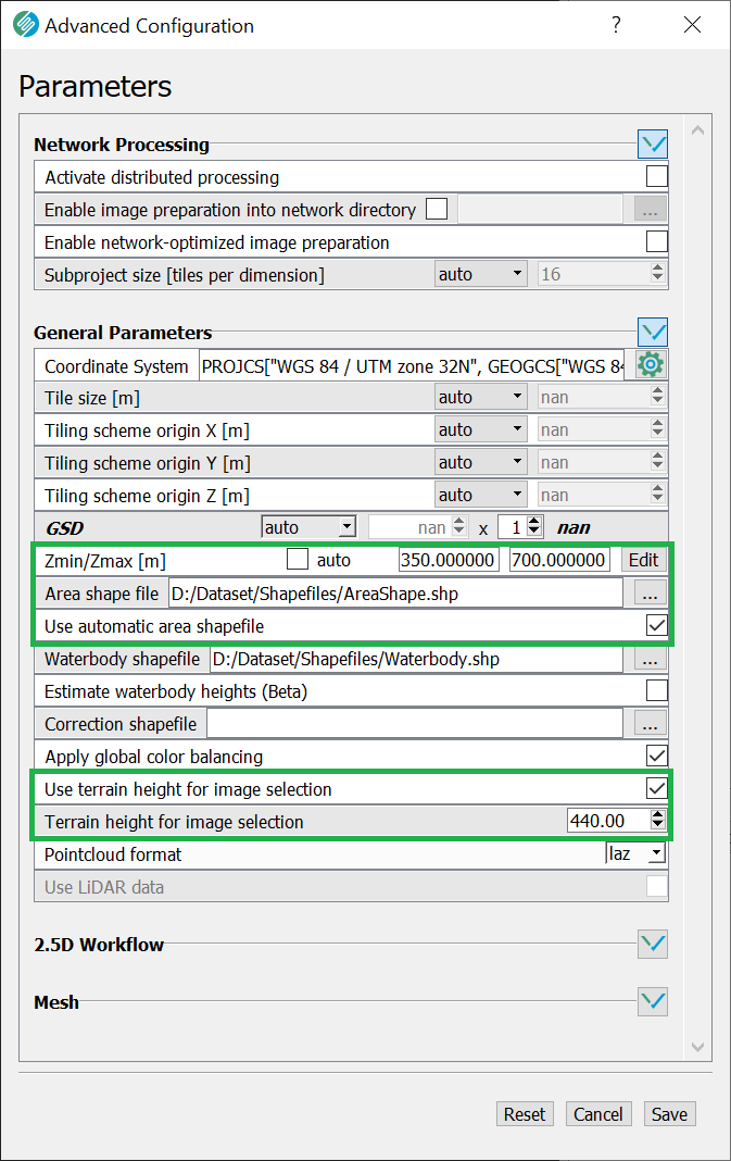
Activating the area-based image selection
Reducing the number of images selected for the project shortens the processing time.
SURE automatically selects the relevant images for the specified Region of Interest whenever the manual 2D Area Shapefile has been given and either a project Terrain Height (average value) or a Z-range is defined.
The Terrain Height can be set manually through the corresponding parameter or it can be automatically extracted from the Inpho *.prj or HxMap *.gori input orientations, if available.
GUI
CLI
SURE.exe --project-directory ...
--area-based-image-selection
--terrain-height-for-image-selection <value>
--area-shapefile path/to/Area.shp
and/or --z-range <zmin> <zmax>