Coordinate System
Specification of an input (non-local) coordinate system is recommended for the majority of workflows and applications. The input coordinate system becomes mandatory in these circumstances:
Georeferencing output products. All exported tif, las, and laz files will contain the georeferencing information assigned to the project, as tags in the files headers.
Exporting the Mesh formats 3D Tiles, SLPK
Providing LiDAR Trajectory files (for the 3D workflow, as part of LiDAR data complementing the Images input)
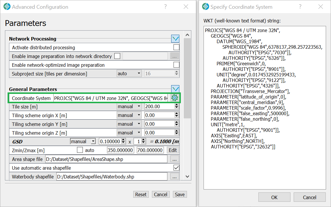
The coordinate system is read through a valid WKT (well-known text) string.
Whenever the Project Input Orientation data are specified using an Inpho *.prj file or HxMap *.gori files, SURE automatically extracts the coordinate system information and applies it to the Project.
The file coordinate_system.wkt found within the Project Directory stores the read WKT string.
Manually setting the coordinate system
GUI
CLI
--coordinate-system path/to/file/containing/wkt/string.wkt
This string / file must refer to the input coordinate system, in which the Images Orientation is.
Coordinate Systems and Transformation Grids
SURE needs transformation grids for some coordinate systems to (accurately) perform coordinate system transformations. Two common situations where this is relevant are:
Vertical geoid-based coordinate systems (for example, as part of a compound coordinate system)
Some horizontal coordinate systems
Depending on all the specified inputs and the requested results, SURE checks whether specific transformation grids are required for coordinate system transformations and will report a warning or an error in case these grids are not available.
Resources for Transformation Grids
Many transformation grids are available in PROJ-data, typically in *.tif / *.gtx file format. They can be downloaded and made available to SURE within an installation directory.
Directory for custom grid
Transformation grids can be installed in two ways:
Recommended: Specify a custom directory by setting the environment variable
SR_PROJ_DATA. All required transformation grid files must reside in one particular folder. Example:SR_PROJ_DATA=C:\custom_gridsCopying them to the SURE installation folder (typically under
C:\Program Files\SURE)
Note: Whether they are saved in the SURE installation folder or in a designated directory via the environment variable, transformation grid files must retain their original names and should be stored directly in the respective folder (no subfolders).
Coordinate System Transformation Report
SURE generates a report cs_trans_report.txt which will be stored in the Internal Directory. This report contains all relevant information regarding coordinate system transformation. All candidate transformations will be listed in this report. The report is structured by requested output (e.g. SLPK or 3D Tiles) or data used as input (LiDAR). In case there are transformation grids missing to get results with higher accuracy, they will be listed as well. The report also contains information about actions if a transformation grid is missing and is referenced in related warnings (see info above).